You are here: Home > Network List > TA - USArray Transportable Network (new EarthScope stations) Stations List
> Station D36A Goodland, MN, USA > Earthquake Result Viewer
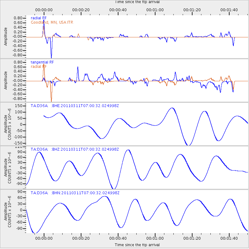
D36A Goodland, MN, USA - Earthquake Result Viewer
*The percent match for this event was below the threshold and hence no stack was calculated.
| Earthquake location: |
Off East Coast Of Honshu, Japan |
| Earthquake latitude/longitude: |
38.0/142.7 |
| Earthquake time(UTC): |
2011/03/11 (070) 06:48:45 GMT |
| Earthquake Depth: |
12 km |
| Earthquake Magnitude: |
6.2 MB |
| Earthquake Catalog/Contributor: |
WHDF/NEIC |
|
| Network: |
TA USArray Transportable Network (new EarthScope stations) |
| Station: |
D36A Goodland, MN, USA |
| Lat/Lon: |
47.18 N/93.16 W |
| Elevation: |
434 m |
|
| Distance: |
81.6 deg |
| Az: |
34.813 deg |
| Baz: |
318.588 deg |
| Ray Param: |
$rayparam |
*The percent match for this event was below the threshold and hence was not used in the summary stack. |
|
| Radial Match: |
50.488525 % |
| Radial Bump: |
293 |
| Transverse Match: |
45.845856 % |
| Transverse Bump: |
400 |
| SOD ConfigId: |
356183 |
| Insert Time: |
2011-08-10 21:29:05.265 +0000 |
| GWidth: |
2.5 |
| Max Bumps: |
400 |
| Tol: |
0.001 |
|
Signal To Noise
| Channel | StoN | STA | LTA |
| TA:D36A: :BHZ:20110311T07:00:32.024998Z | 0.82107836 | 4.3459248E-5 | 5.2929478E-5 |
| TA:D36A: :BHN:20110311T07:00:32.024998Z | 1.1236409 | 5.751509E-5 | 5.1186365E-5 |
| TA:D36A: :BHE:20110311T07:00:32.024998Z | 2.7496848 | 1.2659827E-4 | 4.6041016E-5 |
| Arrivals |
| Ps | |
| PpPs | |
| PsPs/PpSs | |


