You are here: Home > Network List > TA - USArray Transportable Network (new EarthScope stations) Stations List
> Station P39A Salisbury, MO, USA > Earthquake Result Viewer
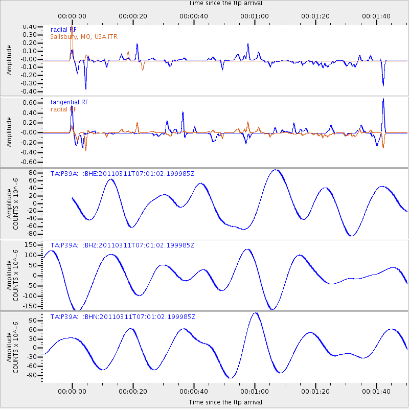
P39A Salisbury, MO, USA - Earthquake Result Viewer
*The percent match for this event was below the threshold and hence no stack was calculated.
| Earthquake location: |
Off East Coast Of Honshu, Japan |
| Earthquake latitude/longitude: |
38.0/142.7 |
| Earthquake time(UTC): |
2011/03/11 (070) 06:48:45 GMT |
| Earthquake Depth: |
12 km |
| Earthquake Magnitude: |
6.2 MB |
| Earthquake Catalog/Contributor: |
WHDF/NEIC |
|
| Network: |
TA USArray Transportable Network (new EarthScope stations) |
| Station: |
P39A Salisbury, MO, USA |
| Lat/Lon: |
39.49 N/92.75 W |
| Elevation: |
232 m |
|
| Distance: |
87.6 deg |
| Az: |
39.653 deg |
| Baz: |
319.322 deg |
| Ray Param: |
$rayparam |
*The percent match for this event was below the threshold and hence was not used in the summary stack. |
|
| Radial Match: |
73.53827 % |
| Radial Bump: |
400 |
| Transverse Match: |
78.86053 % |
| Transverse Bump: |
400 |
| SOD ConfigId: |
356183 |
| Insert Time: |
2011-08-10 21:35:11.492 +0000 |
| GWidth: |
2.5 |
| Max Bumps: |
400 |
| Tol: |
0.001 |
|
Signal To Noise
| Channel | StoN | STA | LTA |
| TA:P39A: :BHZ:20110311T07:01:02.199985Z | 2.7695239 | 1.6616183E-4 | 5.9996535E-5 |
| TA:P39A: :BHN:20110311T07:01:02.199985Z | 0.99714327 | 3.0631847E-5 | 3.0719606E-5 |
| TA:P39A: :BHE:20110311T07:01:02.199985Z | 0.6833307 | 2.5277199E-5 | 3.6991165E-5 |
| Arrivals |
| Ps | |
| PpPs | |
| PsPs/PpSs | |


