You are here: Home > Network List > TA - USArray Transportable Network (new EarthScope stations) Stations List
> Station T38A Diamond, MO, USA > Earthquake Result Viewer
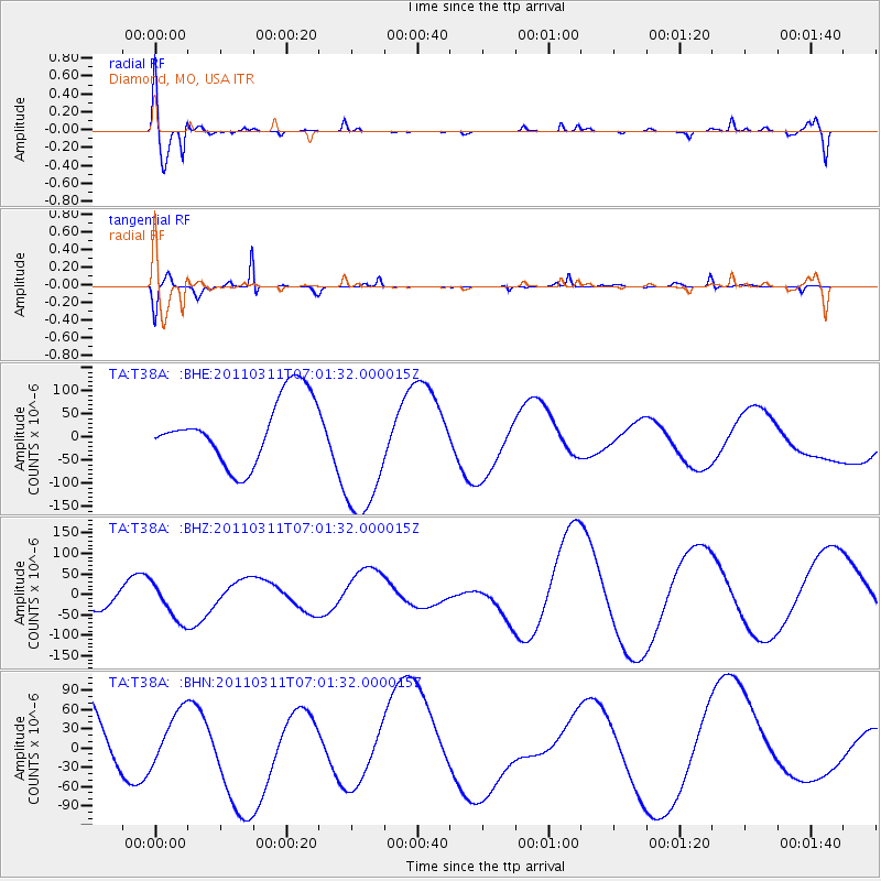
T38A Diamond, MO, USA - Earthquake Result Viewer
*The percent match for this event was below the threshold and hence no stack was calculated.
| Earthquake location: |
Off East Coast Of Honshu, Japan |
| Earthquake latitude/longitude: |
37.3/144.2 |
| Earthquake time(UTC): |
2011/03/11 (070) 06:49:16 GMT |
| Earthquake Depth: |
47 km |
| Earthquake Magnitude: |
6.1 MB |
| Earthquake Catalog/Contributor: |
WHDF/NEIC |
|
| Network: |
TA USArray Transportable Network (new EarthScope stations) |
| Station: |
T38A Diamond, MO, USA |
| Lat/Lon: |
37.04 N/94.29 W |
| Elevation: |
349 m |
|
| Distance: |
88.3 deg |
| Az: |
43.062 deg |
| Baz: |
317.149 deg |
| Ray Param: |
$rayparam |
*The percent match for this event was below the threshold and hence was not used in the summary stack. |
|
| Radial Match: |
49.974518 % |
| Radial Bump: |
400 |
| Transverse Match: |
40.090614 % |
| Transverse Bump: |
200 |
| SOD ConfigId: |
356183 |
| Insert Time: |
2011-08-10 22:56:13.578 +0000 |
| GWidth: |
2.5 |
| Max Bumps: |
400 |
| Tol: |
0.001 |
|
Signal To Noise
| Channel | StoN | STA | LTA |
| TA:T38A: :BHZ:20110311T07:01:32.000015Z | 0.42673525 | 4.3074557E-5 | 1.0093977E-4 |
| TA:T38A: :BHN:20110311T07:01:32.000015Z | 0.7238776 | 4.1058167E-5 | 5.6719764E-5 |
| TA:T38A: :BHE:20110311T07:01:32.000015Z | 2.1988852 | 1.5387857E-4 | 6.998026E-5 |
| Arrivals |
| Ps | |
| PpPs | |
| PsPs/PpSs | |


