You are here: Home > Network List > TA - USArray Transportable Network (new EarthScope stations) Stations List
> Station I28A Midland, SD, USA > Earthquake Result Viewer
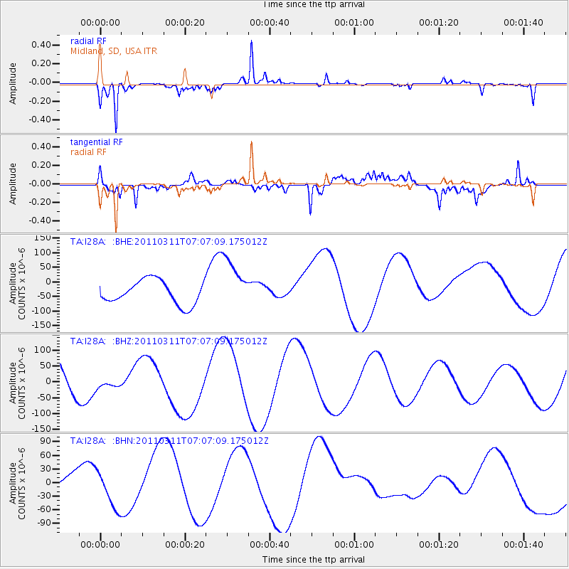
I28A Midland, SD, USA - Earthquake Result Viewer
*The percent match for this event was below the threshold and hence no stack was calculated.
| Earthquake location: |
Off East Coast Of Honshu, Japan |
| Earthquake latitude/longitude: |
37.6/142.9 |
| Earthquake time(UTC): |
2011/03/11 (070) 06:55:33 GMT |
| Earthquake Depth: |
40 km |
| Earthquake Magnitude: |
5.9 MB |
| Earthquake Catalog/Contributor: |
WHDF/NEIC |
|
| Network: |
TA USArray Transportable Network (new EarthScope stations) |
| Station: |
I28A Midland, SD, USA |
| Lat/Lon: |
44.00 N/101.17 W |
| Elevation: |
655 m |
|
| Distance: |
80.3 deg |
| Az: |
41.166 deg |
| Baz: |
313.546 deg |
| Ray Param: |
$rayparam |
*The percent match for this event was below the threshold and hence was not used in the summary stack. |
|
| Radial Match: |
86.2821 % |
| Radial Bump: |
238 |
| Transverse Match: |
61.272808 % |
| Transverse Bump: |
350 |
| SOD ConfigId: |
356183 |
| Insert Time: |
2011-08-11 02:29:22.903 +0000 |
| GWidth: |
2.5 |
| Max Bumps: |
400 |
| Tol: |
0.001 |
|
Signal To Noise
| Channel | StoN | STA | LTA |
| TA:I28A: :BHZ:20110311T07:07:09.175012Z | 0.31236282 | 2.5397801E-5 | 8.130865E-5 |
| TA:I28A: :BHN:20110311T07:07:09.175012Z | 1.7846798 | 4.1226864E-5 | 2.3100425E-5 |
| TA:I28A: :BHE:20110311T07:07:09.175012Z | 2.1246362 | 8.541534E-5 | 4.0202336E-5 |
| Arrivals |
| Ps | |
| PpPs | |
| PsPs/PpSs | |


