You are here: Home > Network List > AZ - ANZA Regional Network Stations List
> Station KNW AZ.KNW > Earthquake Result Viewer
KNW AZ.KNW - Earthquake Result Viewer
*The percent match for this event was below the threshold and hence no stack was calculated.
| Earthquake location: |
Gulf Of Alaska |
| Earthquake latitude/longitude: |
56.2/-147.4 |
| Earthquake time(UTC): |
1999/01/16 (016) 10:44:39 GMT |
| Earthquake Depth: |
21 km |
| Earthquake Magnitude: |
5.9 MB, 5.7 MS, 6.0 MW, 6.0 ME |
| Earthquake Catalog/Contributor: |
WHDF/NEIC |
|
| Network: |
AZ ANZA Regional Network |
| Station: |
KNW AZ.KNW |
| Lat/Lon: |
33.71 N/116.71 W |
| Elevation: |
1507 m |
|
| Distance: |
30.9 deg |
| Az: |
123.89 deg |
| Baz: |
326.213 deg |
| Ray Param: |
$rayparam |
*The percent match for this event was below the threshold and hence was not used in the summary stack. |
|
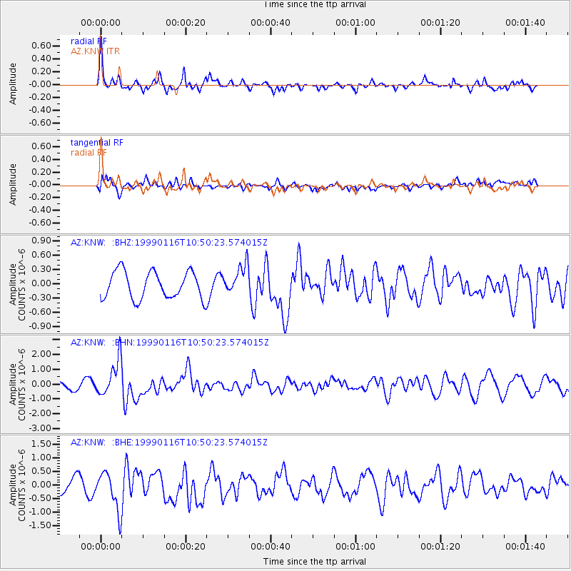
| Radial Match: |
70.76947 % |
| Radial Bump: |
365 |
| Transverse Match: |
66.66647 % |
| Transverse Bump: |
400 |
| SOD ConfigId: |
4480 |
| Insert Time: |
2010-02-26 19:37:51.328 +0000 |
| GWidth: |
2.5 |
| Max Bumps: |
400 |
| Tol: |
0.001 |
|
Signal To Noise
| Channel | StoN | STA | LTA |
| AZ:KNW: :BHN:19990116T10:50:23.574015Z | 3.6534314 | 1.2476686E-6 | 3.4150594E-7 |
| AZ:KNW: :BHE:19990116T10:50:23.574015Z | 1.9102864 | 7.2497807E-7 | 3.7951276E-7 |
| AZ:KNW: :BHZ:19990116T10:50:23.574015Z | 1.0994593 | 3.1213654E-7 | 2.8390005E-7 |
| Arrivals |
| Ps | |
| PpPs | |
| PsPs/PpSs | |


