You are here: Home > Network List > TA - USArray Transportable Network (new EarthScope stations) Stations List
> Station D36A Goodland, MN, USA > Earthquake Result Viewer
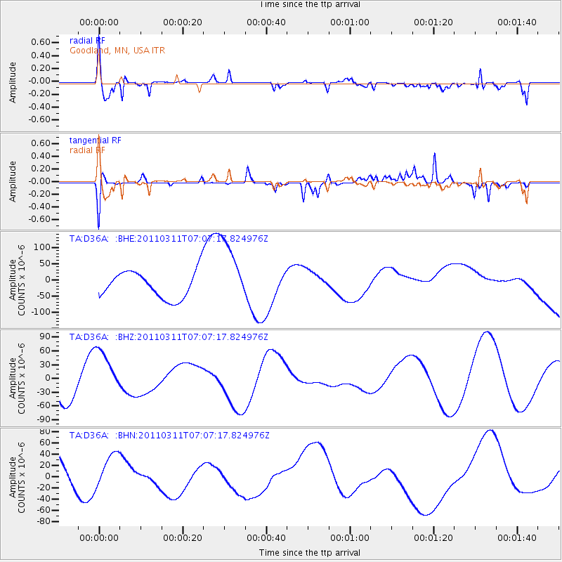
D36A Goodland, MN, USA - Earthquake Result Viewer
*The percent match for this event was below the threshold and hence no stack was calculated.
| Earthquake location: |
Off East Coast Of Honshu, Japan |
| Earthquake latitude/longitude: |
37.6/142.9 |
| Earthquake time(UTC): |
2011/03/11 (070) 06:55:33 GMT |
| Earthquake Depth: |
40 km |
| Earthquake Magnitude: |
5.9 MB |
| Earthquake Catalog/Contributor: |
WHDF/NEIC |
|
| Network: |
TA USArray Transportable Network (new EarthScope stations) |
| Station: |
D36A Goodland, MN, USA |
| Lat/Lon: |
47.18 N/93.16 W |
| Elevation: |
434 m |
|
| Distance: |
81.9 deg |
| Az: |
34.847 deg |
| Baz: |
318.272 deg |
| Ray Param: |
$rayparam |
*The percent match for this event was below the threshold and hence was not used in the summary stack. |
|
| Radial Match: |
46.668785 % |
| Radial Bump: |
400 |
| Transverse Match: |
48.021538 % |
| Transverse Bump: |
219 |
| SOD ConfigId: |
356183 |
| Insert Time: |
2011-08-11 02:58:59.804 +0000 |
| GWidth: |
2.5 |
| Max Bumps: |
400 |
| Tol: |
0.001 |
|
Signal To Noise
| Channel | StoN | STA | LTA |
| TA:D36A: :BHZ:20110311T07:07:17.824976Z | 1.0478233 | 5.4014232E-5 | 5.154899E-5 |
| TA:D36A: :BHN:20110311T07:07:17.824976Z | 1.246656 | 3.502952E-5 | 2.8098788E-5 |
| TA:D36A: :BHE:20110311T07:07:17.824976Z | 2.3851395 | 9.942297E-5 | 4.168434E-5 |
| Arrivals |
| Ps | |
| PpPs | |
| PsPs/PpSs | |


