You are here: Home > Network List > TA - USArray Transportable Network (new EarthScope stations) Stations List
> Station N23A Red Feather Lakes, CO, USA > Earthquake Result Viewer
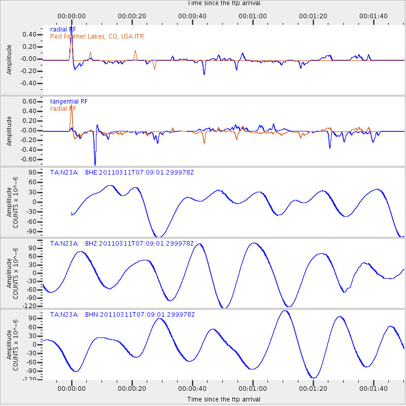
N23A Red Feather Lakes, CO, USA - Earthquake Result Viewer
*The percent match for this event was below the threshold and hence no stack was calculated.
| Earthquake location: |
Near East Coast Of Honshu, Japan |
| Earthquake latitude/longitude: |
35.7/140.9 |
| Earthquake time(UTC): |
2011/03/11 (070) 06:57:16 GMT |
| Earthquake Depth: |
48 km |
| Earthquake Magnitude: |
6.0 MB |
| Earthquake Catalog/Contributor: |
WHDF/NEIC |
|
| Network: |
TA USArray Transportable Network (new EarthScope stations) |
| Station: |
N23A Red Feather Lakes, CO, USA |
| Lat/Lon: |
40.89 N/105.94 W |
| Elevation: |
2458 m |
|
| Distance: |
82.2 deg |
| Az: |
44.703 deg |
| Baz: |
310.962 deg |
| Ray Param: |
$rayparam |
*The percent match for this event was below the threshold and hence was not used in the summary stack. |
|
| Radial Match: |
55.47288 % |
| Radial Bump: |
400 |
| Transverse Match: |
76.29784 % |
| Transverse Bump: |
257 |
| SOD ConfigId: |
356183 |
| Insert Time: |
2011-08-11 04:06:01.244 +0000 |
| GWidth: |
2.5 |
| Max Bumps: |
400 |
| Tol: |
0.001 |
|
Signal To Noise
| Channel | StoN | STA | LTA |
| TA:N23A: :BHZ:20110311T07:09:01.299978Z | 1.6678462 | 7.8528436E-5 | 4.7083737E-5 |
| TA:N23A: :BHN:20110311T07:09:01.299978Z | 12.423864 | 8.817608E-5 | 7.0973147E-6 |
| TA:N23A: :BHE:20110311T07:09:01.299978Z | 3.9866712 | 9.742952E-5 | 2.4438816E-5 |
| Arrivals |
| Ps | |
| PpPs | |
| PsPs/PpSs | |


