You are here: Home > Network List > TA - USArray Transportable Network (new EarthScope stations) Stations List
> Station P31A Stockton, KS, USA > Earthquake Result Viewer
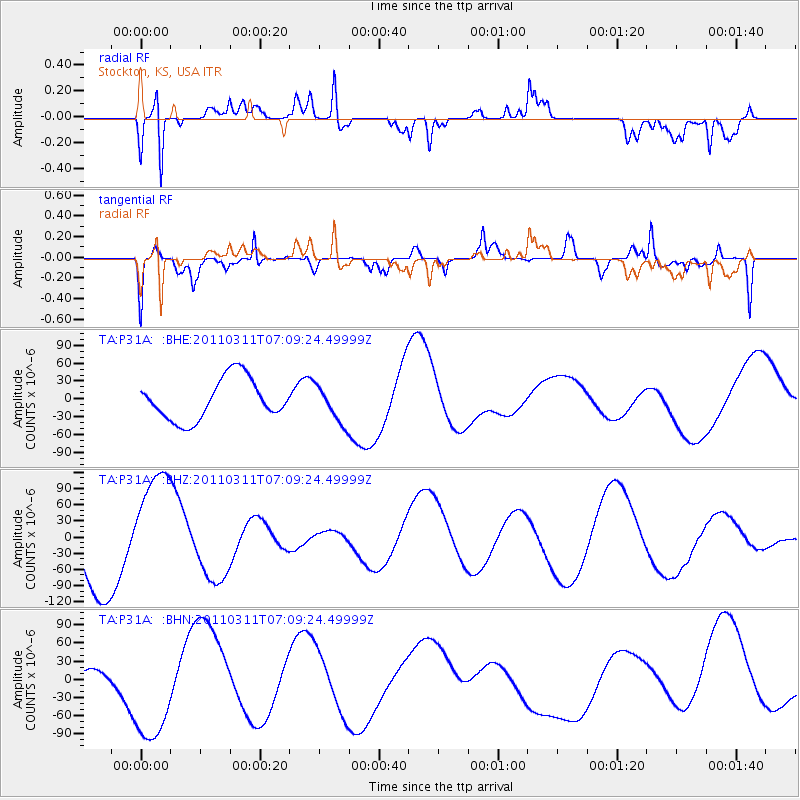
P31A Stockton, KS, USA - Earthquake Result Viewer
*The percent match for this event was below the threshold and hence no stack was calculated.
| Earthquake location: |
Near East Coast Of Honshu, Japan |
| Earthquake latitude/longitude: |
35.7/140.9 |
| Earthquake time(UTC): |
2011/03/11 (070) 06:57:16 GMT |
| Earthquake Depth: |
48 km |
| Earthquake Magnitude: |
6.0 MB |
| Earthquake Catalog/Contributor: |
WHDF/NEIC |
|
| Network: |
TA USArray Transportable Network (new EarthScope stations) |
| Station: |
P31A Stockton, KS, USA |
| Lat/Lon: |
39.52 N/99.38 W |
| Elevation: |
665 m |
|
| Distance: |
86.8 deg |
| Az: |
42.269 deg |
| Baz: |
314.953 deg |
| Ray Param: |
$rayparam |
*The percent match for this event was below the threshold and hence was not used in the summary stack. |
|
| Radial Match: |
48.07189 % |
| Radial Bump: |
316 |
| Transverse Match: |
55.634357 % |
| Transverse Bump: |
400 |
| SOD ConfigId: |
356183 |
| Insert Time: |
2011-08-11 04:08:00.710 +0000 |
| GWidth: |
2.5 |
| Max Bumps: |
400 |
| Tol: |
0.001 |
|
Signal To Noise
| Channel | StoN | STA | LTA |
| TA:P31A: :BHZ:20110311T07:09:24.49999Z | 2.1366024 | 1.0729894E-4 | 5.0219423E-5 |
| TA:P31A: :BHN:20110311T07:09:24.49999Z | 3.7267425 | 9.297369E-5 | 2.494771E-5 |
| TA:P31A: :BHE:20110311T07:09:24.49999Z | 0.90331066 | 3.113952E-5 | 3.4472658E-5 |
| Arrivals |
| Ps | |
| PpPs | |
| PsPs/PpSs | |


