You are here: Home > Network List > TA - USArray Transportable Network (new EarthScope stations) Stations List
> Station 239A Gary, TX, USA > Earthquake Result Viewer
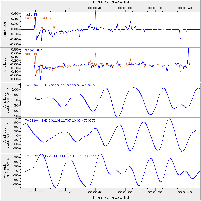
239A Gary, TX, USA - Earthquake Result Viewer
*The percent match for this event was below the threshold and hence no stack was calculated.
| Earthquake location: |
Near East Coast Of Honshu, Japan |
| Earthquake latitude/longitude: |
35.7/140.9 |
| Earthquake time(UTC): |
2011/03/11 (070) 06:57:16 GMT |
| Earthquake Depth: |
48 km |
| Earthquake Magnitude: |
6.0 MB |
| Earthquake Catalog/Contributor: |
WHDF/NEIC |
|
| Network: |
TA USArray Transportable Network (new EarthScope stations) |
| Station: |
239A Gary, TX, USA |
| Lat/Lon: |
32.02 N/94.47 W |
| Elevation: |
100 m |
|
| Distance: |
95.0 deg |
| Az: |
44.54 deg |
| Baz: |
317.782 deg |
| Ray Param: |
$rayparam |
*The percent match for this event was below the threshold and hence was not used in the summary stack. |
|
| Radial Match: |
55.978153 % |
| Radial Bump: |
400 |
| Transverse Match: |
75.67051 % |
| Transverse Bump: |
400 |
| SOD ConfigId: |
356183 |
| Insert Time: |
2011-08-11 04:22:32.876 +0000 |
| GWidth: |
2.5 |
| Max Bumps: |
400 |
| Tol: |
0.001 |
|
Signal To Noise
| Channel | StoN | STA | LTA |
| TA:239A: :BHZ:20110311T07:10:02.475027Z | 0.29812425 | 2.2654207E-5 | 7.598915E-5 |
| TA:239A: :BHN:20110311T07:10:02.475027Z | 1.4842046 | 1.1745127E-4 | 7.913415E-5 |
| TA:239A: :BHE:20110311T07:10:02.475027Z | 1.3582909 | 4.0616425E-5 | 2.9902596E-5 |
| Arrivals |
| Ps | |
| PpPs | |
| PsPs/PpSs | |


