You are here: Home > Network List > TA - USArray Transportable Network (new EarthScope stations) Stations List
> Station Y38A Idabel, OK, USA > Earthquake Result Viewer
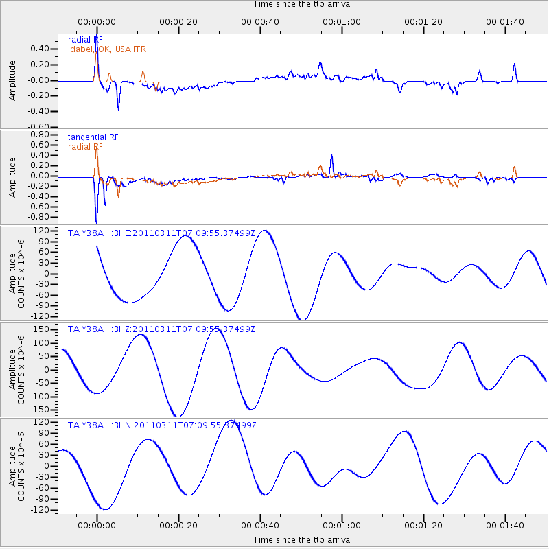
Y38A Idabel, OK, USA - Earthquake Result Viewer
*The percent match for this event was below the threshold and hence no stack was calculated.
| Earthquake location: |
Near East Coast Of Honshu, Japan |
| Earthquake latitude/longitude: |
35.7/140.9 |
| Earthquake time(UTC): |
2011/03/11 (070) 06:57:16 GMT |
| Earthquake Depth: |
48 km |
| Earthquake Magnitude: |
6.0 MB |
| Earthquake Catalog/Contributor: |
WHDF/NEIC |
|
| Network: |
TA USArray Transportable Network (new EarthScope stations) |
| Station: |
Y38A Idabel, OK, USA |
| Lat/Lon: |
33.93 N/94.73 W |
| Elevation: |
118 m |
|
| Distance: |
93.4 deg |
| Az: |
43.418 deg |
| Baz: |
317.722 deg |
| Ray Param: |
$rayparam |
*The percent match for this event was below the threshold and hence was not used in the summary stack. |
|
| Radial Match: |
73.614044 % |
| Radial Bump: |
400 |
| Transverse Match: |
78.76781 % |
| Transverse Bump: |
400 |
| SOD ConfigId: |
356183 |
| Insert Time: |
2011-08-11 04:25:12.525 +0000 |
| GWidth: |
2.5 |
| Max Bumps: |
400 |
| Tol: |
0.001 |
|
Signal To Noise
| Channel | StoN | STA | LTA |
| TA:Y38A: :BHZ:20110311T07:09:55.37499Z | 1.1535623 | 7.007476E-5 | 6.0746403E-5 |
| TA:Y38A: :BHN:20110311T07:09:55.37499Z | 3.0192516 | 1.382404E-4 | 4.5786317E-5 |
| TA:Y38A: :BHE:20110311T07:09:55.37499Z | 1.3076442 | 8.727096E-5 | 6.673906E-5 |
| Arrivals |
| Ps | |
| PpPs | |
| PsPs/PpSs | |


