You are here: Home > Network List > TA - USArray Transportable Network (new EarthScope stations) Stations List
> Station A33A Warroad, MN, USA > Earthquake Result Viewer
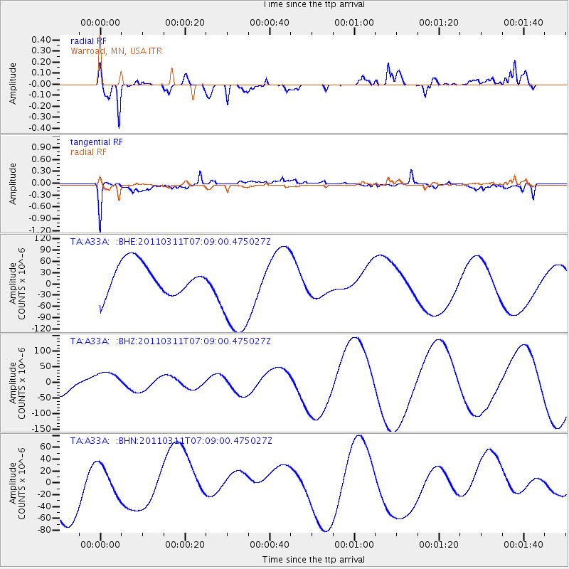
A33A Warroad, MN, USA - Earthquake Result Viewer
*The percent match for this event was below the threshold and hence no stack was calculated.
| Earthquake location: |
Near East Coast Of Honshu, Japan |
| Earthquake latitude/longitude: |
35.7/140.9 |
| Earthquake time(UTC): |
2011/03/11 (070) 06:57:16 GMT |
| Earthquake Depth: |
48 km |
| Earthquake Magnitude: |
6.0 MB |
| Earthquake Catalog/Contributor: |
WHDF/NEIC |
|
| Network: |
TA USArray Transportable Network (new EarthScope stations) |
| Station: |
A33A Warroad, MN, USA |
| Lat/Lon: |
48.94 N/95.39 W |
| Elevation: |
329 m |
|
| Distance: |
82.0 deg |
| Az: |
33.623 deg |
| Baz: |
316.89 deg |
| Ray Param: |
$rayparam |
*The percent match for this event was below the threshold and hence was not used in the summary stack. |
|
| Radial Match: |
64.56962 % |
| Radial Bump: |
400 |
| Transverse Match: |
64.44746 % |
| Transverse Bump: |
400 |
| SOD ConfigId: |
356183 |
| Insert Time: |
2011-08-11 04:34:49.583 +0000 |
| GWidth: |
2.5 |
| Max Bumps: |
400 |
| Tol: |
0.001 |
|
Signal To Noise
| Channel | StoN | STA | LTA |
| TA:A33A: :BHZ:20110311T07:09:00.475027Z | 1.0937122 | 3.3699096E-5 | 3.0811665E-5 |
| TA:A33A: :BHN:20110311T07:09:00.475027Z | 0.4762229 | 2.4236968E-5 | 5.0894167E-5 |
| TA:A33A: :BHE:20110311T07:09:00.475027Z | 3.1587436 | 1.2923556E-4 | 4.0913597E-5 |
| Arrivals |
| Ps | |
| PpPs | |
| PsPs/PpSs | |


