You are here: Home > Network List > UW - Pacific Northwest Regional Seismic Network Stations List
> Station LEBA Lebam, WA, USA > Earthquake Result Viewer
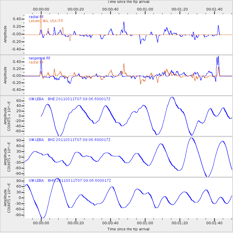
LEBA Lebam, WA, USA - Earthquake Result Viewer
*The percent match for this event was below the threshold and hence no stack was calculated.
| Earthquake location: |
Off East Coast Of Honshu, Japan |
| Earthquake latitude/longitude: |
37.4/144.7 |
| Earthquake time(UTC): |
2011/03/11 (070) 06:59:00 GMT |
| Earthquake Depth: |
36 km |
| Earthquake Magnitude: |
6.3 MB |
| Earthquake Catalog/Contributor: |
WHDF/NEIC |
|
| Network: |
UW Pacific Northwest Regional Seismic Network |
| Station: |
LEBA Lebam, WA, USA |
| Lat/Lon: |
46.55 N/123.56 W |
| Elevation: |
73 m |
|
| Distance: |
65.1 deg |
| Az: |
49.508 deg |
| Baz: |
298.6 deg |
| Ray Param: |
$rayparam |
*The percent match for this event was below the threshold and hence was not used in the summary stack. |
|
| Radial Match: |
38.21612 % |
| Radial Bump: |
289 |
| Transverse Match: |
60.8227 % |
| Transverse Bump: |
400 |
| SOD ConfigId: |
356183 |
| Insert Time: |
2011-08-11 06:21:06.171 +0000 |
| GWidth: |
2.5 |
| Max Bumps: |
400 |
| Tol: |
0.001 |
|
Signal To Noise
| Channel | StoN | STA | LTA |
| UW:LEBA: :BHZ:20110311T07:09:06.600017Z | 0.8736587 | 1.9961582E-5 | 2.284826E-5 |
| UW:LEBA: :BHN:20110311T07:09:06.600017Z | 2.2323482 | 9.124419E-5 | 4.0873638E-5 |
| UW:LEBA: :BHE:20110311T07:09:06.600017Z | 0.52278817 | 2.1205744E-5 | 4.0562783E-5 |
| Arrivals |
| Ps | |
| PpPs | |
| PsPs/PpSs | |


