You are here: Home > Network List > CI - Caltech Regional Seismic Network Stations List
> Station MPM Manuel Prospect Mine, California, USA > Earthquake Result Viewer
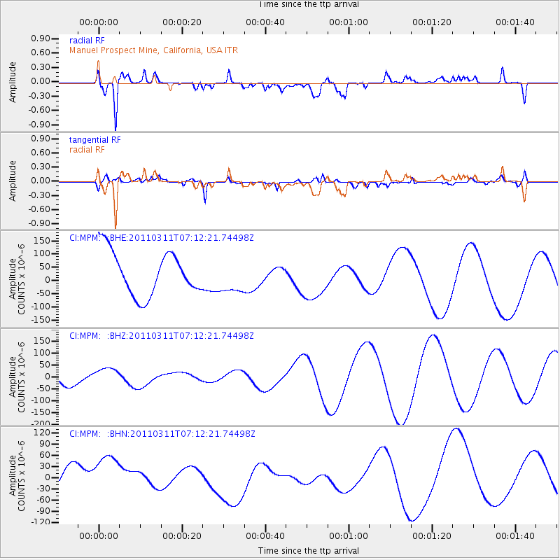
MPM Manuel Prospect Mine, California, USA - Earthquake Result Viewer
*The percent match for this event was below the threshold and hence no stack was calculated.
| Earthquake location: |
Off East Coast Of Honshu, Japan |
| Earthquake latitude/longitude: |
36.6/143.8 |
| Earthquake time(UTC): |
2011/03/11 (070) 07:01:11 GMT |
| Earthquake Depth: |
36 km |
| Earthquake Magnitude: |
5.7 MB |
| Earthquake Catalog/Contributor: |
WHDF/NEIC |
|
| Network: |
CI Caltech Regional Seismic Network |
| Station: |
MPM Manuel Prospect Mine, California, USA |
| Lat/Lon: |
36.06 N/117.49 W |
| Elevation: |
185 m |
|
| Distance: |
75.6 deg |
| Az: |
55.779 deg |
| Baz: |
304.825 deg |
| Ray Param: |
$rayparam |
*The percent match for this event was below the threshold and hence was not used in the summary stack. |
|
| Radial Match: |
87.575 % |
| Radial Bump: |
400 |
| Transverse Match: |
64.045334 % |
| Transverse Bump: |
400 |
| SOD ConfigId: |
356183 |
| Insert Time: |
2011-08-11 06:42:52.940 +0000 |
| GWidth: |
2.5 |
| Max Bumps: |
400 |
| Tol: |
0.001 |
|
Signal To Noise
| Channel | StoN | STA | LTA |
| CI:MPM: :BHZ:20110311T07:12:21.74498Z | 0.8066191 | 3.7897786E-5 | 4.6983496E-5 |
| CI:MPM: :BHN:20110311T07:12:21.74498Z | 1.8345531 | 8.1456485E-5 | 4.440127E-5 |
| CI:MPM: :BHE:20110311T07:12:21.74498Z | 0.7826889 | 6.3900865E-5 | 8.164274E-5 |
| Arrivals |
| Ps | |
| PpPs | |
| PsPs/PpSs | |


