You are here: Home > Network List > TA - USArray Transportable Network (new EarthScope stations) Stations List
> Station M29A Burnside Ranch, Stapleton, NE, USA > Earthquake Result Viewer
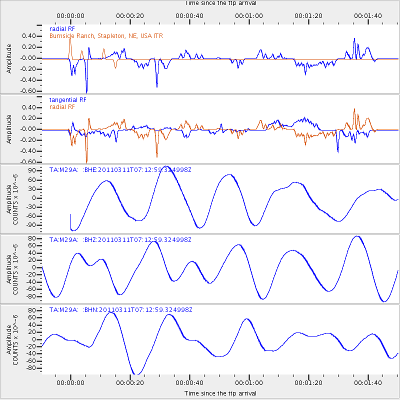
M29A Burnside Ranch, Stapleton, NE, USA - Earthquake Result Viewer
*The percent match for this event was below the threshold and hence no stack was calculated.
| Earthquake location: |
Off East Coast Of Honshu, Japan |
| Earthquake latitude/longitude: |
36.6/143.8 |
| Earthquake time(UTC): |
2011/03/11 (070) 07:01:11 GMT |
| Earthquake Depth: |
36 km |
| Earthquake Magnitude: |
5.7 MB |
| Earthquake Catalog/Contributor: |
WHDF/NEIC |
|
| Network: |
TA USArray Transportable Network (new EarthScope stations) |
| Station: |
M29A Burnside Ranch, Stapleton, NE, USA |
| Lat/Lon: |
41.44 N/100.69 W |
| Elevation: |
952 m |
|
| Distance: |
82.5 deg |
| Az: |
43.167 deg |
| Baz: |
312.943 deg |
| Ray Param: |
$rayparam |
*The percent match for this event was below the threshold and hence was not used in the summary stack. |
|
| Radial Match: |
84.37817 % |
| Radial Bump: |
303 |
| Transverse Match: |
77.81313 % |
| Transverse Bump: |
400 |
| SOD ConfigId: |
356183 |
| Insert Time: |
2011-08-11 07:11:39.576 +0000 |
| GWidth: |
2.5 |
| Max Bumps: |
400 |
| Tol: |
0.001 |
|
Signal To Noise
| Channel | StoN | STA | LTA |
| TA:M29A: :BHZ:20110311T07:12:59.324998Z | 0.399776 | 2.4773024E-5 | 6.196726E-5 |
| TA:M29A: :BHN:20110311T07:12:59.324998Z | 0.35799244 | 5.5554806E-6 | 1.551843E-5 |
| TA:M29A: :BHE:20110311T07:12:59.324998Z | 2.1713395 | 1.1713622E-4 | 5.394652E-5 |
| Arrivals |
| Ps | |
| PpPs | |
| PsPs/PpSs | |


