You are here: Home > Network List > TA - USArray Transportable Network (new EarthScope stations) Stations List
> Station Y36A Durant, OK, USA > Earthquake Result Viewer
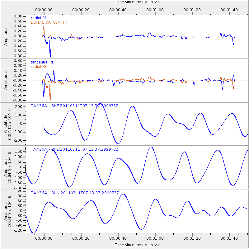
Y36A Durant, OK, USA - Earthquake Result Viewer
*The percent match for this event was below the threshold and hence no stack was calculated.
| Earthquake location: |
Off East Coast Of Honshu, Japan |
| Earthquake latitude/longitude: |
36.6/143.8 |
| Earthquake time(UTC): |
2011/03/11 (070) 07:01:11 GMT |
| Earthquake Depth: |
36 km |
| Earthquake Magnitude: |
5.7 MB |
| Earthquake Catalog/Contributor: |
WHDF/NEIC |
|
| Network: |
TA USArray Transportable Network (new EarthScope stations) |
| Station: |
Y36A Durant, OK, USA |
| Lat/Lon: |
33.90 N/96.28 W |
| Elevation: |
186 m |
|
| Distance: |
90.2 deg |
| Az: |
46.105 deg |
| Baz: |
315.817 deg |
| Ray Param: |
$rayparam |
*The percent match for this event was below the threshold and hence was not used in the summary stack. |
|
| Radial Match: |
88.145325 % |
| Radial Bump: |
400 |
| Transverse Match: |
72.43847 % |
| Transverse Bump: |
368 |
| SOD ConfigId: |
356183 |
| Insert Time: |
2011-08-11 07:26:36.492 +0000 |
| GWidth: |
2.5 |
| Max Bumps: |
400 |
| Tol: |
0.001 |
|
Signal To Noise
| Channel | StoN | STA | LTA |
| TA:Y36A: :BHZ:20110311T07:13:37.299973Z | 2.8841527 | 1.6379861E-4 | 5.6792633E-5 |
| TA:Y36A: :BHN:20110311T07:13:37.299973Z | 0.70486885 | 4.6529807E-5 | 6.6012006E-5 |
| TA:Y36A: :BHE:20110311T07:13:37.299973Z | 2.120425 | 2.3562815E-4 | 1.1112308E-4 |
| Arrivals |
| Ps | |
| PpPs | |
| PsPs/PpSs | |


