You are here: Home > Network List > TA - USArray Transportable Network (new EarthScope stations) Stations List
> Station Z37A Pogue Cattle Company, Sulphur Springs, TX, USA > Earthquake Result Viewer
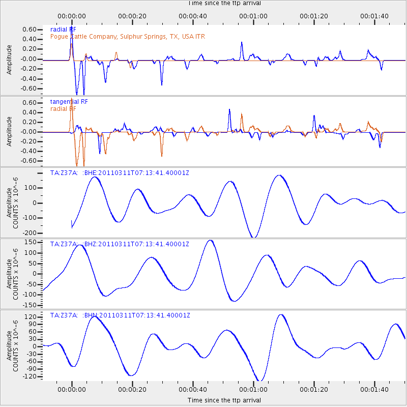
Z37A Pogue Cattle Company, Sulphur Springs, TX, USA - Earthquake Result Viewer
*The percent match for this event was below the threshold and hence no stack was calculated.
| Earthquake location: |
Off East Coast Of Honshu, Japan |
| Earthquake latitude/longitude: |
36.6/143.8 |
| Earthquake time(UTC): |
2011/03/11 (070) 07:01:11 GMT |
| Earthquake Depth: |
36 km |
| Earthquake Magnitude: |
5.7 MB |
| Earthquake Catalog/Contributor: |
WHDF/NEIC |
|
| Network: |
TA USArray Transportable Network (new EarthScope stations) |
| Station: |
Z37A Pogue Cattle Company, Sulphur Springs, TX, USA |
| Lat/Lon: |
33.20 N/95.62 W |
| Elevation: |
146 m |
|
| Distance: |
91.1 deg |
| Az: |
46.193 deg |
| Baz: |
316.18 deg |
| Ray Param: |
$rayparam |
*The percent match for this event was below the threshold and hence was not used in the summary stack. |
|
| Radial Match: |
68.18306 % |
| Radial Bump: |
268 |
| Transverse Match: |
46.668167 % |
| Transverse Bump: |
182 |
| SOD ConfigId: |
356183 |
| Insert Time: |
2011-08-11 07:26:36.564 +0000 |
| GWidth: |
2.5 |
| Max Bumps: |
400 |
| Tol: |
0.001 |
|
Signal To Noise
| Channel | StoN | STA | LTA |
| TA:Z37A: :BHZ:20110311T07:13:41.40001Z | 2.582856 | 1.3961105E-4 | 5.4052973E-5 |
| TA:Z37A: :BHN:20110311T07:13:41.40001Z | 1.9639663 | 5.124885E-5 | 2.6094567E-5 |
| TA:Z37A: :BHE:20110311T07:13:41.40001Z | 0.60388666 | 5.9475875E-5 | 9.848847E-5 |
| Arrivals |
| Ps | |
| PpPs | |
| PsPs/PpSs | |


