You are here: Home > Network List > TA - USArray Transportable Network (new EarthScope stations) Stations List
> Station J33A Davis, SD, USA > Earthquake Result Viewer
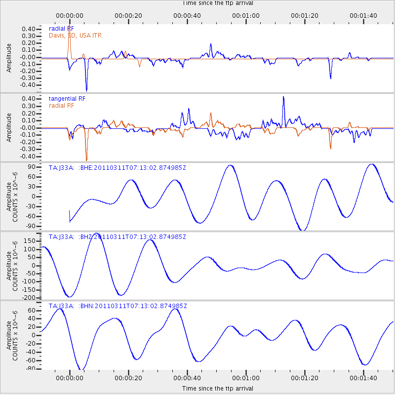
J33A Davis, SD, USA - Earthquake Result Viewer
*The percent match for this event was below the threshold and hence no stack was calculated.
| Earthquake location: |
Off East Coast Of Honshu, Japan |
| Earthquake latitude/longitude: |
36.6/143.8 |
| Earthquake time(UTC): |
2011/03/11 (070) 07:01:11 GMT |
| Earthquake Depth: |
36 km |
| Earthquake Magnitude: |
5.7 MB |
| Earthquake Catalog/Contributor: |
WHDF/NEIC |
|
| Network: |
TA USArray Transportable Network (new EarthScope stations) |
| Station: |
J33A Davis, SD, USA |
| Lat/Lon: |
43.32 N/96.97 W |
| Elevation: |
400 m |
|
| Distance: |
83.2 deg |
| Az: |
39.879 deg |
| Baz: |
315.033 deg |
| Ray Param: |
$rayparam |
*The percent match for this event was below the threshold and hence was not used in the summary stack. |
|
| Radial Match: |
90.95229 % |
| Radial Bump: |
372 |
| Transverse Match: |
86.71708 % |
| Transverse Bump: |
400 |
| SOD ConfigId: |
356183 |
| Insert Time: |
2011-08-11 07:31:52.486 +0000 |
| GWidth: |
2.5 |
| Max Bumps: |
400 |
| Tol: |
0.001 |
|
Signal To Noise
| Channel | StoN | STA | LTA |
| TA:J33A: :BHZ:20110311T07:13:02.874985Z | 2.399352 | 1.6476178E-4 | 6.866928E-5 |
| TA:J33A: :BHN:20110311T07:13:02.874985Z | 2.267077 | 5.6283287E-5 | 2.4826368E-5 |
| TA:J33A: :BHE:20110311T07:13:02.874985Z | 0.9317086 | 2.9220466E-5 | 3.1362237E-5 |
| Arrivals |
| Ps | |
| PpPs | |
| PsPs/PpSs | |


