You are here: Home > Network List > TA - USArray Transportable Network (new EarthScope stations) Stations List
> Station C33A Trail, MN, USA > Earthquake Result Viewer
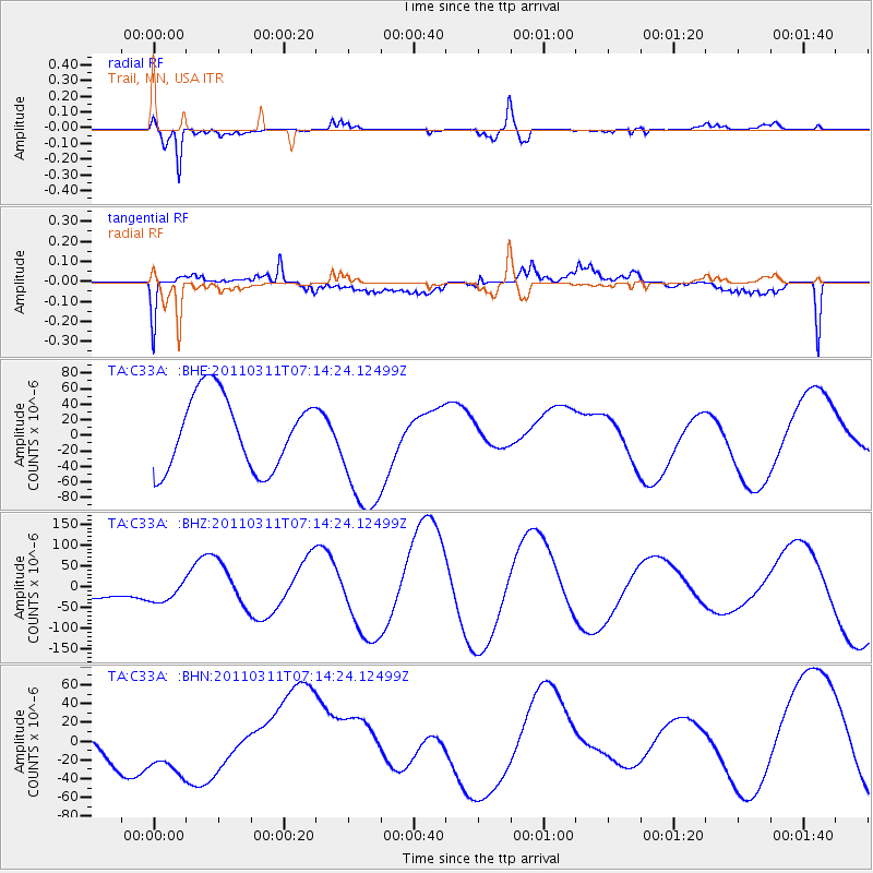
C33A Trail, MN, USA - Earthquake Result Viewer
*The percent match for this event was below the threshold and hence no stack was calculated.
| Earthquake location: |
Near East Coast Of Honshu, Japan |
| Earthquake latitude/longitude: |
39.7/142.5 |
| Earthquake time(UTC): |
2011/03/11 (070) 07:02:57 GMT |
| Earthquake Depth: |
42 km |
| Earthquake Magnitude: |
5.8 MB |
| Earthquake Catalog/Contributor: |
WHDF/NEIC |
|
| Network: |
TA USArray Transportable Network (new EarthScope stations) |
| Station: |
C33A Trail, MN, USA |
| Lat/Lon: |
47.76 N/95.77 W |
| Elevation: |
388 m |
|
| Distance: |
78.7 deg |
| Az: |
35.833 deg |
| Baz: |
317.975 deg |
| Ray Param: |
$rayparam |
*The percent match for this event was below the threshold and hence was not used in the summary stack. |
|
| Radial Match: |
41.321266 % |
| Radial Bump: |
319 |
| Transverse Match: |
38.200947 % |
| Transverse Bump: |
400 |
| SOD ConfigId: |
356183 |
| Insert Time: |
2011-08-11 09:07:27.530 +0000 |
| GWidth: |
2.5 |
| Max Bumps: |
400 |
| Tol: |
0.001 |
|
Signal To Noise
| Channel | StoN | STA | LTA |
| TA:C33A: :BHZ:20110311T07:14:24.12499Z | 0.35270044 | 2.1594522E-5 | 6.1226245E-5 |
| TA:C33A: :BHN:20110311T07:14:24.12499Z | 1.3139398 | 3.822309E-5 | 2.9090443E-5 |
| TA:C33A: :BHE:20110311T07:14:24.12499Z | 1.7758428 | 8.245099E-5 | 4.6429217E-5 |
| Arrivals |
| Ps | |
| PpPs | |
| PsPs/PpSs | |


