You are here: Home > Network List > TA - USArray Transportable Network (new EarthScope stations) Stations List
> Station G35A Watkins, MN, USA > Earthquake Result Viewer
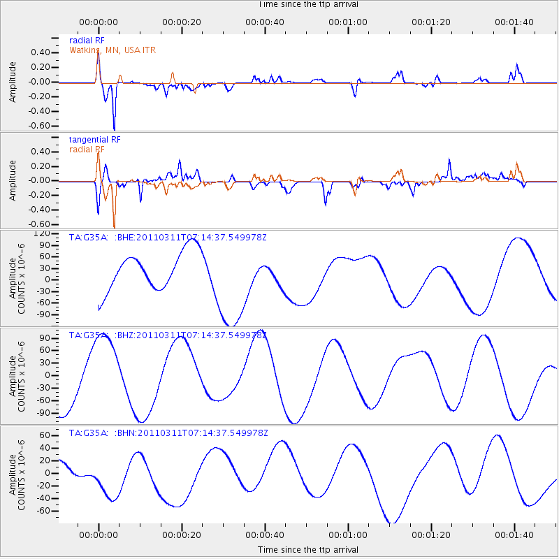
G35A Watkins, MN, USA - Earthquake Result Viewer
*The percent match for this event was below the threshold and hence no stack was calculated.
| Earthquake location: |
Near East Coast Of Honshu, Japan |
| Earthquake latitude/longitude: |
39.7/142.5 |
| Earthquake time(UTC): |
2011/03/11 (070) 07:02:57 GMT |
| Earthquake Depth: |
42 km |
| Earthquake Magnitude: |
5.8 MB |
| Earthquake Catalog/Contributor: |
WHDF/NEIC |
|
| Network: |
TA USArray Transportable Network (new EarthScope stations) |
| Station: |
G35A Watkins, MN, USA |
| Lat/Lon: |
45.22 N/94.49 W |
| Elevation: |
361 m |
|
| Distance: |
81.2 deg |
| Az: |
36.864 deg |
| Baz: |
319.085 deg |
| Ray Param: |
$rayparam |
*The percent match for this event was below the threshold and hence was not used in the summary stack. |
|
| Radial Match: |
65.951706 % |
| Radial Bump: |
400 |
| Transverse Match: |
65.04451 % |
| Transverse Bump: |
400 |
| SOD ConfigId: |
356183 |
| Insert Time: |
2011-08-11 09:08:22.796 +0000 |
| GWidth: |
2.5 |
| Max Bumps: |
400 |
| Tol: |
0.001 |
|
Signal To Noise
| Channel | StoN | STA | LTA |
| TA:G35A: :BHZ:20110311T07:14:37.549978Z | 1.4324262 | 9.679574E-5 | 6.757467E-5 |
| TA:G35A: :BHN:20110311T07:14:37.549978Z | 1.4519569 | 3.915973E-5 | 2.6970312E-5 |
| TA:G35A: :BHE:20110311T07:14:37.549978Z | 2.694748 | 1.3168989E-4 | 4.8869093E-5 |
| Arrivals |
| Ps | |
| PpPs | |
| PsPs/PpSs | |


