You are here: Home > Network List > TA - USArray Transportable Network (new EarthScope stations) Stations List
> Station A33A Warroad, MN, USA > Earthquake Result Viewer
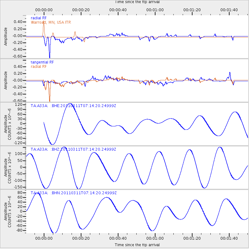
A33A Warroad, MN, USA - Earthquake Result Viewer
*The percent match for this event was below the threshold and hence no stack was calculated.
| Earthquake location: |
Near East Coast Of Honshu, Japan |
| Earthquake latitude/longitude: |
39.7/142.5 |
| Earthquake time(UTC): |
2011/03/11 (070) 07:02:57 GMT |
| Earthquake Depth: |
42 km |
| Earthquake Magnitude: |
5.8 MB |
| Earthquake Catalog/Contributor: |
WHDF/NEIC |
|
| Network: |
TA USArray Transportable Network (new EarthScope stations) |
| Station: |
A33A Warroad, MN, USA |
| Lat/Lon: |
48.94 N/95.39 W |
| Elevation: |
329 m |
|
| Distance: |
78.0 deg |
| Az: |
34.834 deg |
| Baz: |
318.058 deg |
| Ray Param: |
$rayparam |
*The percent match for this event was below the threshold and hence was not used in the summary stack. |
|
| Radial Match: |
79.73652 % |
| Radial Bump: |
400 |
| Transverse Match: |
44.707798 % |
| Transverse Bump: |
400 |
| SOD ConfigId: |
356183 |
| Insert Time: |
2011-08-11 09:09:12.227 +0000 |
| GWidth: |
2.5 |
| Max Bumps: |
400 |
| Tol: |
0.001 |
|
Signal To Noise
| Channel | StoN | STA | LTA |
| TA:A33A: :BHZ:20110311T07:14:20.24999Z | 2.9489033 | 1.4480558E-4 | 4.910489E-5 |
| TA:A33A: :BHN:20110311T07:14:20.24999Z | 2.3358476 | 5.395737E-5 | 2.3099696E-5 |
| TA:A33A: :BHE:20110311T07:14:20.24999Z | 0.23567073 | 1.9647941E-5 | 8.337031E-5 |
| Arrivals |
| Ps | |
| PpPs | |
| PsPs/PpSs | |


