You are here: Home > Network List > US - United States National Seismic Network Stations List
> Station MNTX Cornudas Mountains, Texas, USA > Earthquake Result Viewer
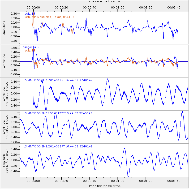
MNTX Cornudas Mountains, Texas, USA - Earthquake Result Viewer
*The percent match for this event was below the threshold and hence no stack was calculated.
| Earthquake location: |
Santa Cruz Islands |
| Earthquake latitude/longitude: |
-11.9/165.3 |
| Earthquake time(UTC): |
2014/01/27 (027) 16:31:12 GMT |
| Earthquake Depth: |
35 km |
| Earthquake Magnitude: |
5.2 MW |
| Earthquake Catalog/Contributor: |
ISC/ISC |
|
| Network: |
US United States National Seismic Network |
| Station: |
MNTX Cornudas Mountains, Texas, USA |
| Lat/Lon: |
31.70 N/105.38 W |
| Elevation: |
404 m |
|
| Distance: |
95.6 deg |
| Az: |
58.91 deg |
| Baz: |
259.55 deg |
| Ray Param: |
$rayparam |
*The percent match for this event was below the threshold and hence was not used in the summary stack. |
|
| Radial Match: |
55.11785 % |
| Radial Bump: |
400 |
| Transverse Match: |
62.834286 % |
| Transverse Bump: |
400 |
| SOD ConfigId: |
3390531 |
| Insert Time: |
2019-04-10 03:47:28.158 +0000 |
| GWidth: |
2.5 |
| Max Bumps: |
400 |
| Tol: |
0.001 |
|
Signal To Noise
| Channel | StoN | STA | LTA |
| US:MNTX:00:BHZ:20140127T16:44:02.324014Z | 0.38736534 | 1.0462471E-7 | 2.7009312E-7 |
| US:MNTX:00:BH1:20140127T16:44:02.324014Z | 1.2406744 | 2.5428326E-7 | 2.0495568E-7 |
| US:MNTX:00:BH2:20140127T16:44:02.324014Z | 0.80150455 | 1.9186677E-7 | 2.3938327E-7 |
| Arrivals |
| Ps | |
| PpPs | |
| PsPs/PpSs | |


