You are here: Home > Network List > WY - Yellowstone Wyoming Seismic Network Stations List
> Station YHH Holmes Hill, YNP, WY, USA > Earthquake Result Viewer
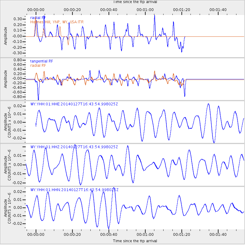
YHH Holmes Hill, YNP, WY, USA - Earthquake Result Viewer
*The percent match for this event was below the threshold and hence no stack was calculated.
| Earthquake location: |
Santa Cruz Islands |
| Earthquake latitude/longitude: |
-11.9/165.3 |
| Earthquake time(UTC): |
2014/01/27 (027) 16:31:12 GMT |
| Earthquake Depth: |
35 km |
| Earthquake Magnitude: |
5.2 MW |
| Earthquake Catalog/Contributor: |
ISC/ISC |
|
| Network: |
WY Yellowstone Wyoming Seismic Network |
| Station: |
YHH Holmes Hill, YNP, WY, USA |
| Lat/Lon: |
44.79 N/110.85 W |
| Elevation: |
2717 m |
|
| Distance: |
93.9 deg |
| Az: |
45.206 deg |
| Baz: |
257.295 deg |
| Ray Param: |
$rayparam |
*The percent match for this event was below the threshold and hence was not used in the summary stack. |
|
| Radial Match: |
58.49326 % |
| Radial Bump: |
284 |
| Transverse Match: |
80.1044 % |
| Transverse Bump: |
330 |
| SOD ConfigId: |
3390531 |
| Insert Time: |
2019-04-10 03:47:41.753 +0000 |
| GWidth: |
2.5 |
| Max Bumps: |
400 |
| Tol: |
0.001 |
|
Signal To Noise
| Channel | StoN | STA | LTA |
| WY:YHH:01:HHZ:20140127T16:43:54.998025Z | 2.3182244 | 1.224813E-8 | 5.2834093E-9 |
| WY:YHH:01:HHN:20140127T16:43:54.998025Z | 1.2696652 | 1.1679592E-8 | 9.198954E-9 |
| WY:YHH:01:HHE:20140127T16:43:54.998025Z | 1.7156942 | 1.1393628E-8 | 6.640827E-9 |
| Arrivals |
| Ps | |
| PpPs | |
| PsPs/PpSs | |


