You are here: Home > Network List > TA - USArray Transportable Network (new EarthScope stations) Stations List
> Station O37A Wolven Farm, McFall, MO, USA > Earthquake Result Viewer
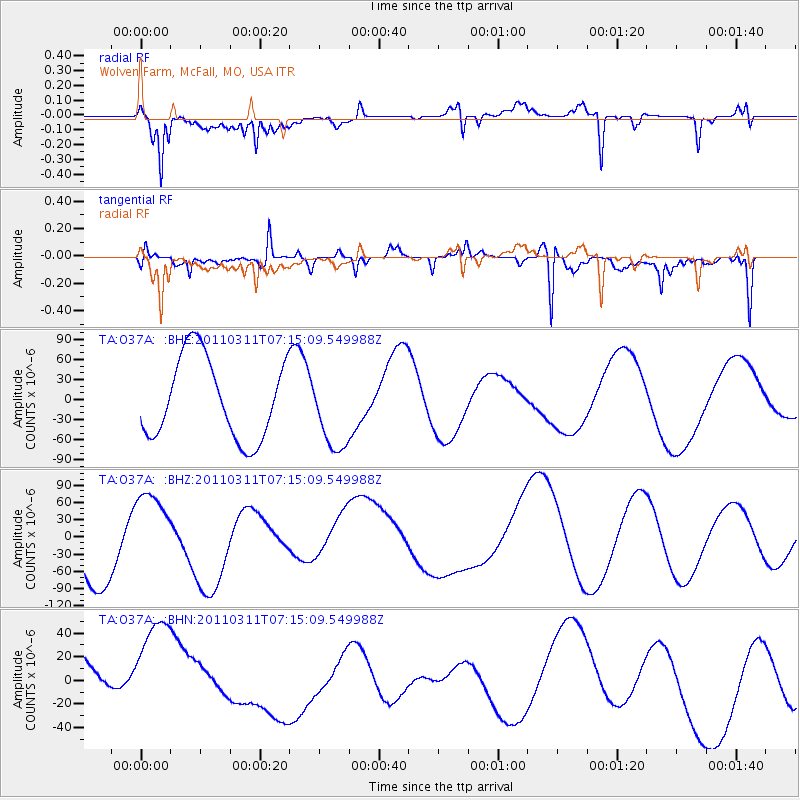
O37A Wolven Farm, McFall, MO, USA - Earthquake Result Viewer
*The percent match for this event was below the threshold and hence no stack was calculated.
| Earthquake location: |
Off East Coast Of Honshu, Japan |
| Earthquake latitude/longitude: |
37.9/142.8 |
| Earthquake time(UTC): |
2011/03/11 (070) 07:03:00 GMT |
| Earthquake Depth: |
19 km |
| Earthquake Magnitude: |
5.6 MB |
| Earthquake Catalog/Contributor: |
WHDF/NEIC |
|
| Network: |
TA USArray Transportable Network (new EarthScope stations) |
| Station: |
O37A Wolven Farm, McFall, MO, USA |
| Lat/Lon: |
40.17 N/94.15 W |
| Elevation: |
284 m |
|
| Distance: |
86.4 deg |
| Az: |
40.058 deg |
| Baz: |
318.382 deg |
| Ray Param: |
$rayparam |
*The percent match for this event was below the threshold and hence was not used in the summary stack. |
|
| Radial Match: |
71.61672 % |
| Radial Bump: |
400 |
| Transverse Match: |
74.6251 % |
| Transverse Bump: |
400 |
| SOD ConfigId: |
356183 |
| Insert Time: |
2011-08-11 10:59:08.864 +0000 |
| GWidth: |
2.5 |
| Max Bumps: |
400 |
| Tol: |
0.001 |
|
Signal To Noise
| Channel | StoN | STA | LTA |
| TA:O37A: :BHZ:20110311T07:15:09.549988Z | 1.0622628 | 6.9954374E-5 | 6.585412E-5 |
| TA:O37A: :BHN:20110311T07:15:09.549988Z | 1.773549 | 5.7706944E-5 | 3.2537555E-5 |
| TA:O37A: :BHE:20110311T07:15:09.549988Z | 0.98590004 | 5.937593E-5 | 6.02251E-5 |
| Arrivals |
| Ps | |
| PpPs | |
| PsPs/PpSs | |


