You are here: Home > Network List > GS - US Geological Survey Networks Stations List
> Station DEC07 Harrison Ave Surface Site > Earthquake Result Viewer
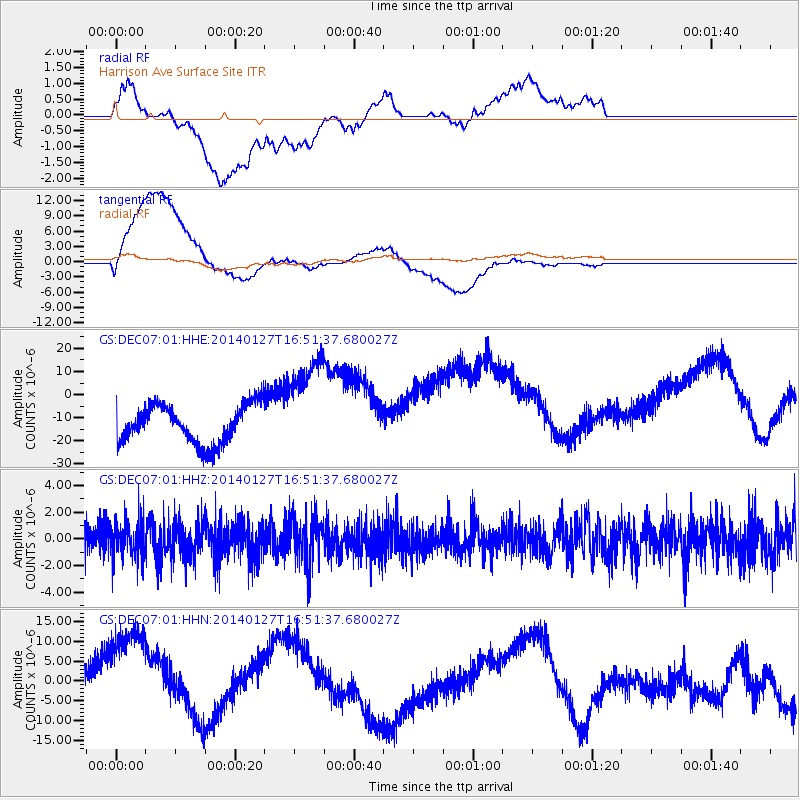
DEC07 Harrison Ave Surface Site - Earthquake Result Viewer
*The percent match for this event was below the threshold and hence no stack was calculated.
| Earthquake location: |
Southern Bolivia |
| Earthquake latitude/longitude: |
-19.3/-63.9 |
| Earthquake time(UTC): |
2014/01/27 (027) 16:42:37 GMT |
| Earthquake Depth: |
600 km |
| Earthquake Magnitude: |
5.6 MWB |
| Earthquake Catalog/Contributor: |
NEIC PDE/NEIC COMCAT |
|
| Network: |
GS US Geological Survey Networks |
| Station: |
DEC07 Harrison Ave Surface Site |
| Lat/Lon: |
39.86 N/88.90 W |
| Elevation: |
212 m |
|
| Distance: |
63.3 deg |
| Az: |
338.659 deg |
| Baz: |
153.468 deg |
| Ray Param: |
$rayparam |
*The percent match for this event was below the threshold and hence was not used in the summary stack. |
|
| Radial Match: |
25.630522 % |
| Radial Bump: |
400 |
| Transverse Match: |
38.59615 % |
| Transverse Bump: |
400 |
| SOD ConfigId: |
3390531 |
| Insert Time: |
2019-04-10 03:50:01.259 +0000 |
| GWidth: |
2.5 |
| Max Bumps: |
400 |
| Tol: |
0.001 |
|
Signal To Noise
| Channel | StoN | STA | LTA |
| GS:DEC07:01:HHZ:20140127T16:51:37.680027Z | 1.0997666 | 1.3632425E-6 | 1.2395744E-6 |
| GS:DEC07:01:HHN:20140127T16:51:37.680027Z | 2.692312 | 1.6538263E-5 | 6.1427736E-6 |
| GS:DEC07:01:HHE:20140127T16:51:37.680027Z | 2.726645 | 2.2893995E-5 | 8.396398E-6 |
| Arrivals |
| Ps | |
| PpPs | |
| PsPs/PpSs | |


