You are here: Home > Network List > UW - Pacific Northwest Regional Seismic Network Stations List
> Station MRBL Marblemount, WA, USA > Earthquake Result Viewer
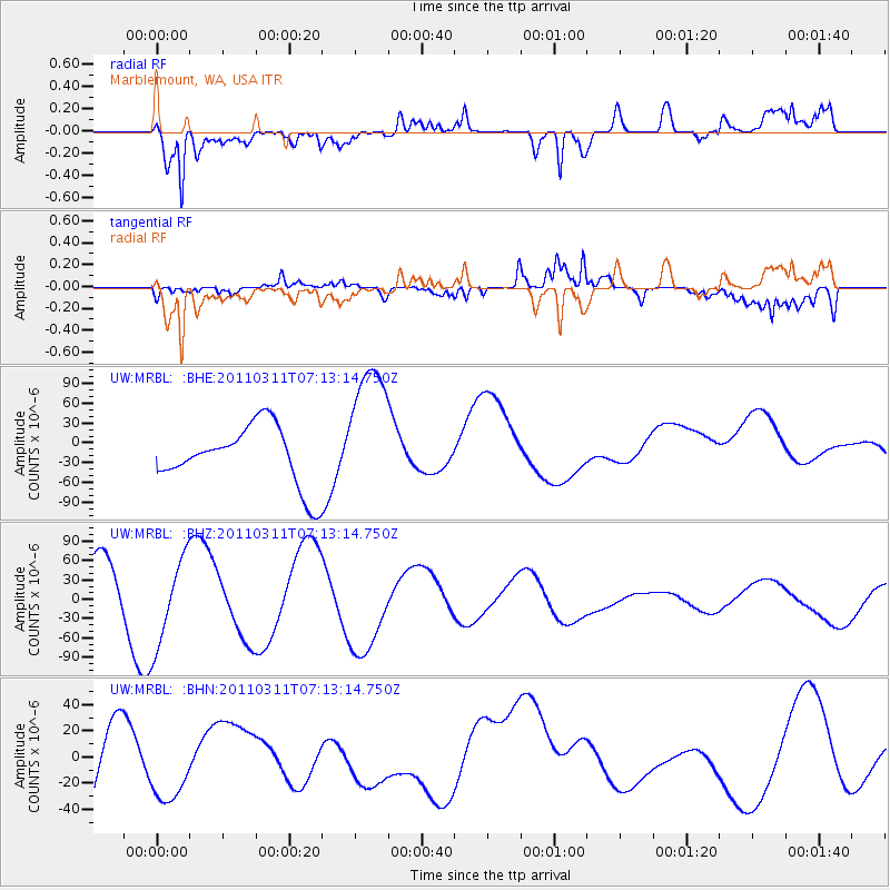
MRBL Marblemount, WA, USA - Earthquake Result Viewer
*The percent match for this event was below the threshold and hence no stack was calculated.
| Earthquake location: |
Off East Coast Of Honshu, Japan |
| Earthquake latitude/longitude: |
37.9/142.8 |
| Earthquake time(UTC): |
2011/03/11 (070) 07:03:00 GMT |
| Earthquake Depth: |
19 km |
| Earthquake Magnitude: |
5.6 MB |
| Earthquake Catalog/Contributor: |
WHDF/NEIC |
|
| Network: |
UW Pacific Northwest Regional Seismic Network |
| Station: |
MRBL Marblemount, WA, USA |
| Lat/Lon: |
48.52 N/121.48 W |
| Elevation: |
75 m |
|
| Distance: |
66.1 deg |
| Az: |
46.345 deg |
| Baz: |
300.62 deg |
| Ray Param: |
$rayparam |
*The percent match for this event was below the threshold and hence was not used in the summary stack. |
|
| Radial Match: |
80.55136 % |
| Radial Bump: |
400 |
| Transverse Match: |
70.35855 % |
| Transverse Bump: |
400 |
| SOD ConfigId: |
356183 |
| Insert Time: |
2011-08-11 11:15:34.556 +0000 |
| GWidth: |
2.5 |
| Max Bumps: |
400 |
| Tol: |
0.001 |
|
Signal To Noise
| Channel | StoN | STA | LTA |
| UW:MRBL: :BHZ:20110311T07:13:14.750Z | 1.5079598 | 6.8923066E-5 | 4.5706165E-5 |
| UW:MRBL: :BHN:20110311T07:13:14.750Z | 0.80510175 | 3.2167296E-5 | 3.995432E-5 |
| UW:MRBL: :BHE:20110311T07:13:14.750Z | 2.3927329 | 1.06708525E-4 | 4.4596924E-5 |
| Arrivals |
| Ps | |
| PpPs | |
| PsPs/PpSs | |


