You are here: Home > Network List > CI - Caltech Regional Seismic Network Stations List
> Station TIN Tinemaha, Big Pine, CA, USA > Earthquake Result Viewer
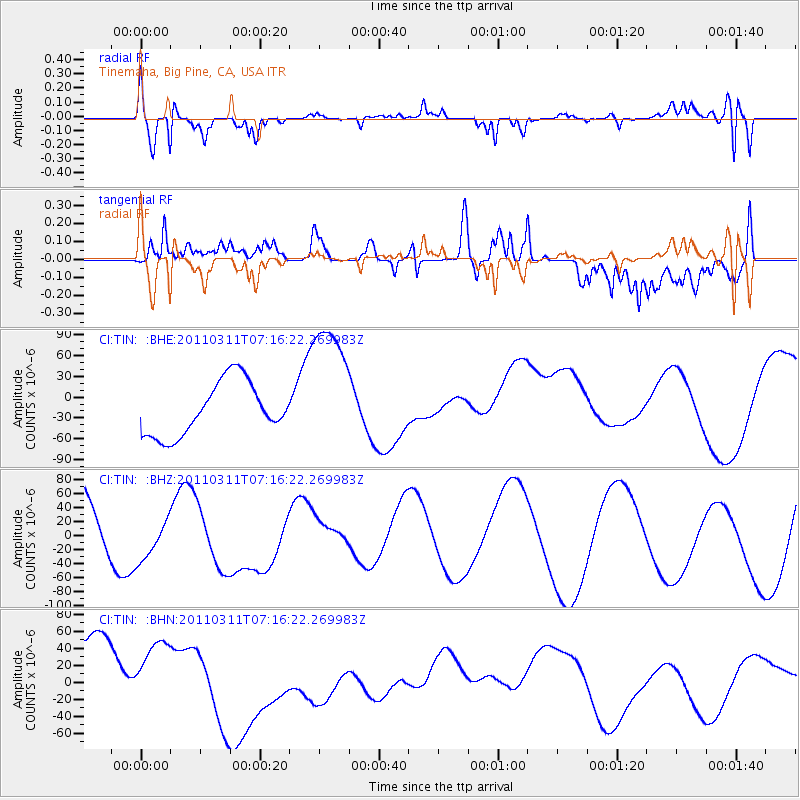
TIN Tinemaha, Big Pine, CA, USA - Earthquake Result Viewer
*The percent match for this event was below the threshold and hence no stack was calculated.
| Earthquake location: |
Off East Coast Of Honshu, Japan |
| Earthquake latitude/longitude: |
38.4/143.6 |
| Earthquake time(UTC): |
2011/03/11 (070) 07:05:21 GMT |
| Earthquake Depth: |
15 km |
| Earthquake Magnitude: |
5.7 MB |
| Earthquake Catalog/Contributor: |
WHDF/NEIC |
|
| Network: |
CI Caltech Regional Seismic Network |
| Station: |
TIN Tinemaha, Big Pine, CA, USA |
| Lat/Lon: |
37.05 N/118.23 W |
| Elevation: |
1197 m |
|
| Distance: |
73.6 deg |
| Az: |
55.633 deg |
| Baz: |
305.881 deg |
| Ray Param: |
$rayparam |
*The percent match for this event was below the threshold and hence was not used in the summary stack. |
|
| Radial Match: |
73.358246 % |
| Radial Bump: |
376 |
| Transverse Match: |
57.27432 % |
| Transverse Bump: |
400 |
| SOD ConfigId: |
356183 |
| Insert Time: |
2011-08-11 13:25:12.016 +0000 |
| GWidth: |
2.5 |
| Max Bumps: |
400 |
| Tol: |
0.001 |
|
Signal To Noise
| Channel | StoN | STA | LTA |
| CI:TIN: :BHZ:20110311T07:16:22.269983Z | 0.6409105 | 3.062446E-5 | 4.7782738E-5 |
| CI:TIN: :BHN:20110311T07:16:22.269983Z | 1.0337198 | 4.8268786E-5 | 4.6694266E-5 |
| CI:TIN: :BHE:20110311T07:16:22.269983Z | 2.5994866 | 1.0029238E-4 | 3.8581613E-5 |
| Arrivals |
| Ps | |
| PpPs | |
| PsPs/PpSs | |


