You are here: Home > Network List > TA - USArray Transportable Network (new EarthScope stations) Stations List
> Station V32A Arapaho, OK, USA > Earthquake Result Viewer
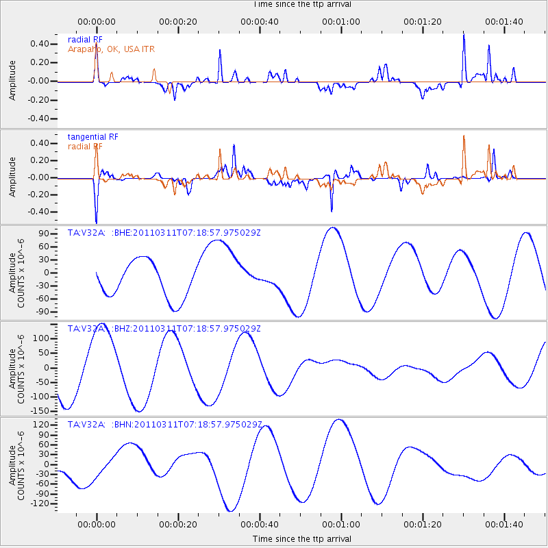
V32A Arapaho, OK, USA - Earthquake Result Viewer
*The percent match for this event was below the threshold and hence no stack was calculated.
| Earthquake location: |
Off East Coast Of Honshu, Japan |
| Earthquake latitude/longitude: |
37.8/143.0 |
| Earthquake time(UTC): |
2011/03/11 (070) 07:06:45 GMT |
| Earthquake Depth: |
22 km |
| Earthquake Magnitude: |
5.6 MB |
| Earthquake Catalog/Contributor: |
WHDF/NEIC |
|
| Network: |
TA USArray Transportable Network (new EarthScope stations) |
| Station: |
V32A Arapaho, OK, USA |
| Lat/Lon: |
35.72 N/99.04 W |
| Elevation: |
533 m |
|
| Distance: |
87.0 deg |
| Az: |
46.023 deg |
| Baz: |
315.514 deg |
| Ray Param: |
$rayparam |
*The percent match for this event was below the threshold and hence was not used in the summary stack. |
|
| Radial Match: |
80.04999 % |
| Radial Bump: |
340 |
| Transverse Match: |
89.12015 % |
| Transverse Bump: |
229 |
| SOD ConfigId: |
356183 |
| Insert Time: |
2011-08-11 15:59:24.897 +0000 |
| GWidth: |
2.5 |
| Max Bumps: |
400 |
| Tol: |
0.001 |
|
Signal To Noise
| Channel | StoN | STA | LTA |
| TA:V32A: :BHZ:20110311T07:18:57.975029Z | 1.7702956 | 1.4517628E-4 | 8.20068E-5 |
| TA:V32A: :BHN:20110311T07:18:57.975029Z | 0.6521039 | 2.7224682E-5 | 4.1748994E-5 |
| TA:V32A: :BHE:20110311T07:18:57.975029Z | 1.9815238 | 7.938319E-5 | 4.0061692E-5 |
| Arrivals |
| Ps | |
| PpPs | |
| PsPs/PpSs | |


