You are here: Home > Network List > TA - USArray Transportable Network (new EarthScope stations) Stations List
> Station N35A Tabor, IA, USA > Earthquake Result Viewer
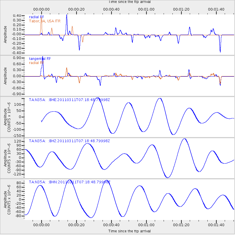
N35A Tabor, IA, USA - Earthquake Result Viewer
*The percent match for this event was below the threshold and hence no stack was calculated.
| Earthquake location: |
Off East Coast Of Honshu, Japan |
| Earthquake latitude/longitude: |
37.8/143.0 |
| Earthquake time(UTC): |
2011/03/11 (070) 07:06:45 GMT |
| Earthquake Depth: |
22 km |
| Earthquake Magnitude: |
5.6 MB |
| Earthquake Catalog/Contributor: |
WHDF/NEIC |
|
| Network: |
TA USArray Transportable Network (new EarthScope stations) |
| Station: |
N35A Tabor, IA, USA |
| Lat/Lon: |
40.86 N/95.64 W |
| Elevation: |
353 m |
|
| Distance: |
85.1 deg |
| Az: |
40.532 deg |
| Baz: |
317.24 deg |
| Ray Param: |
$rayparam |
*The percent match for this event was below the threshold and hence was not used in the summary stack. |
|
| Radial Match: |
42.431236 % |
| Radial Bump: |
269 |
| Transverse Match: |
51.291573 % |
| Transverse Bump: |
214 |
| SOD ConfigId: |
356183 |
| Insert Time: |
2011-08-11 16:08:12.723 +0000 |
| GWidth: |
2.5 |
| Max Bumps: |
400 |
| Tol: |
0.001 |
|
Signal To Noise
| Channel | StoN | STA | LTA |
| TA:N35A: :BHZ:20110311T07:18:48.79998Z | 1.5393265 | 4.7473488E-5 | 3.0840427E-5 |
| TA:N35A: :BHN:20110311T07:18:48.79998Z | 1.2871389 | 5.2984946E-5 | 4.11649E-5 |
| TA:N35A: :BHE:20110311T07:18:48.79998Z | 2.9969153 | 1.5466928E-4 | 5.160949E-5 |
| Arrivals |
| Ps | |
| PpPs | |
| PsPs/PpSs | |


