You are here: Home > Network List > US - United States National Seismic Network Stations List
> Station HAWA Hanford, Washington, USA > Earthquake Result Viewer
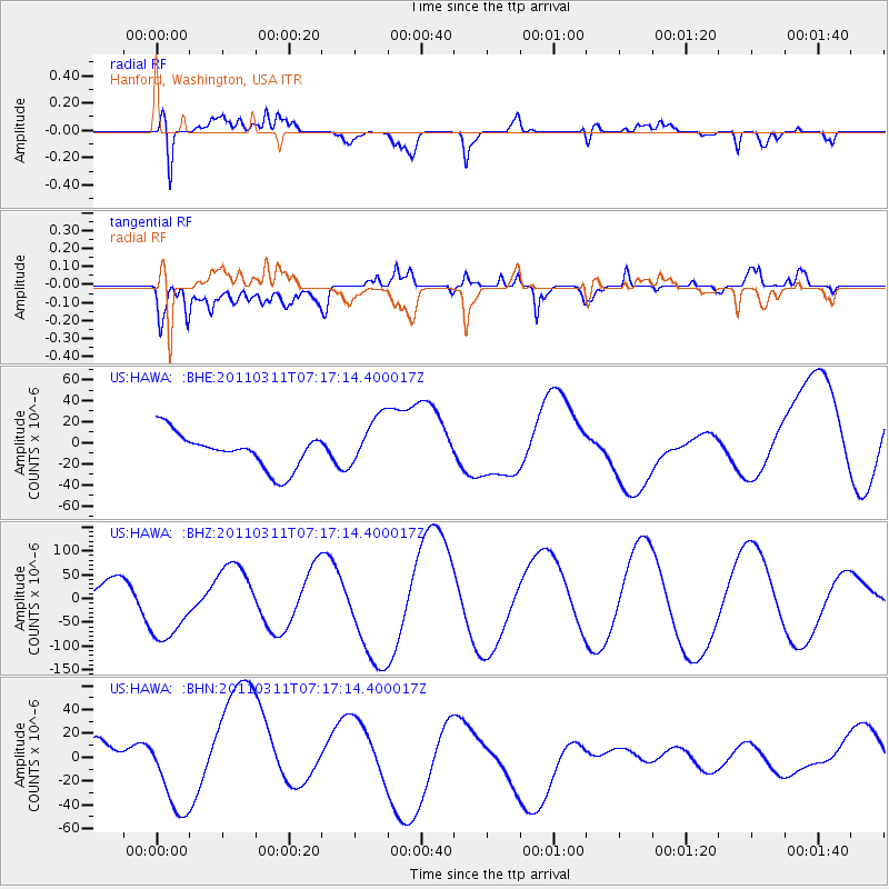
HAWA Hanford, Washington, USA - Earthquake Result Viewer
*The percent match for this event was below the threshold and hence no stack was calculated.
| Earthquake location: |
Off East Coast Of Honshu, Japan |
| Earthquake latitude/longitude: |
37.8/143.0 |
| Earthquake time(UTC): |
2011/03/11 (070) 07:06:45 GMT |
| Earthquake Depth: |
22 km |
| Earthquake Magnitude: |
5.6 MB |
| Earthquake Catalog/Contributor: |
WHDF/NEIC |
|
| Network: |
US United States National Seismic Network |
| Station: |
HAWA Hanford, Washington, USA |
| Lat/Lon: |
46.39 N/119.53 W |
| Elevation: |
364 m |
|
| Distance: |
68.4 deg |
| Az: |
47.586 deg |
| Baz: |
302.305 deg |
| Ray Param: |
$rayparam |
*The percent match for this event was below the threshold and hence was not used in the summary stack. |
|
| Radial Match: |
74.55457 % |
| Radial Bump: |
400 |
| Transverse Match: |
50.869785 % |
| Transverse Bump: |
400 |
| SOD ConfigId: |
356183 |
| Insert Time: |
2011-08-11 16:30:34.239 +0000 |
| GWidth: |
2.5 |
| Max Bumps: |
400 |
| Tol: |
0.001 |
|
Signal To Noise
| Channel | StoN | STA | LTA |
| US:HAWA: :BHZ:20110311T07:17:14.400017Z | 3.6378481 | 7.629173E-5 | 2.0971665E-5 |
| US:HAWA: :BHN:20110311T07:17:14.400017Z | 0.7771389 | 2.7776805E-5 | 3.5742396E-5 |
| US:HAWA: :BHE:20110311T07:17:14.400017Z | 1.5216358 | 2.5455893E-5 | 1.6729295E-5 |
| Arrivals |
| Ps | |
| PpPs | |
| PsPs/PpSs | |


