You are here: Home > Network List > TA - USArray Transportable Network (new EarthScope stations) Stations List
> Station 336A Riesel, TX, USA > Earthquake Result Viewer
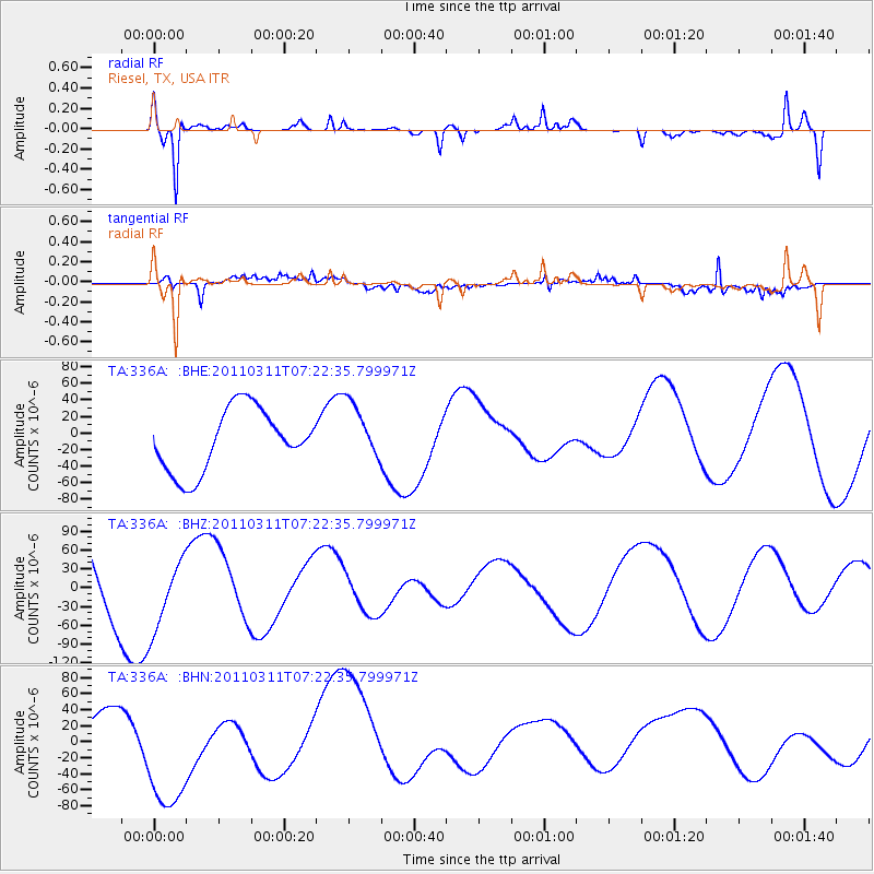
336A Riesel, TX, USA - Earthquake Result Viewer
*The percent match for this event was below the threshold and hence no stack was calculated.
| Earthquake location: |
Near East Coast Of Honshu, Japan |
| Earthquake latitude/longitude: |
36.7/141.9 |
| Earthquake time(UTC): |
2011/03/11 (070) 07:09:58 GMT |
| Earthquake Depth: |
35 km |
| Earthquake Magnitude: |
5.6 MB |
| Earthquake Catalog/Contributor: |
WHDF/NEIC |
|
| Network: |
TA USArray Transportable Network (new EarthScope stations) |
| Station: |
336A Riesel, TX, USA |
| Lat/Lon: |
31.39 N/96.84 W |
| Elevation: |
140 m |
|
| Distance: |
92.8 deg |
| Az: |
47.022 deg |
| Baz: |
316.577 deg |
| Ray Param: |
$rayparam |
*The percent match for this event was below the threshold and hence was not used in the summary stack. |
|
| Radial Match: |
80.880554 % |
| Radial Bump: |
400 |
| Transverse Match: |
75.784454 % |
| Transverse Bump: |
391 |
| SOD ConfigId: |
356183 |
| Insert Time: |
2011-08-11 19:14:38.209 +0000 |
| GWidth: |
2.5 |
| Max Bumps: |
400 |
| Tol: |
0.001 |
|
Signal To Noise
| Channel | StoN | STA | LTA |
| TA:336A: :BHZ:20110311T07:22:35.799971Z | 0.77620244 | 5.7525598E-5 | 7.4111595E-5 |
| TA:336A: :BHN:20110311T07:22:35.799971Z | 4.3777356 | 8.099856E-5 | 1.8502386E-5 |
| TA:336A: :BHE:20110311T07:22:35.799971Z | 0.9481779 | 3.572846E-5 | 3.7681177E-5 |
| Arrivals |
| Ps | |
| PpPs | |
| PsPs/PpSs | |


