You are here: Home > Network List > TA - USArray Transportable Network (new EarthScope stations) Stations List
> Station M36A Felix, Anita, IA, USA > Earthquake Result Viewer
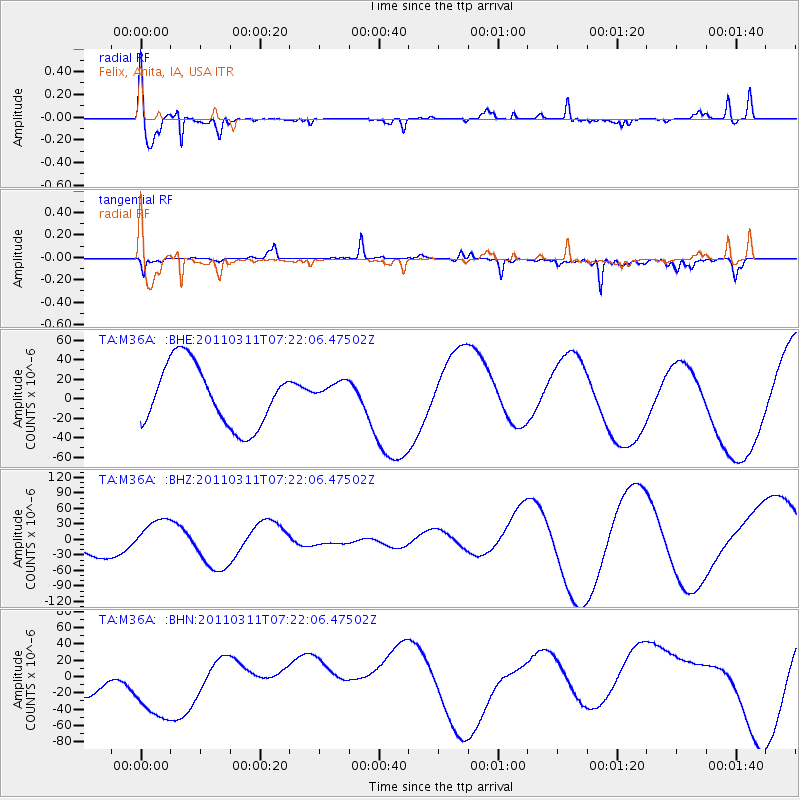
M36A Felix, Anita, IA, USA - Earthquake Result Viewer
*The percent match for this event was below the threshold and hence no stack was calculated.
| Earthquake location: |
Near East Coast Of Honshu, Japan |
| Earthquake latitude/longitude: |
36.7/141.9 |
| Earthquake time(UTC): |
2011/03/11 (070) 07:09:58 GMT |
| Earthquake Depth: |
35 km |
| Earthquake Magnitude: |
5.6 MB |
| Earthquake Catalog/Contributor: |
WHDF/NEIC |
|
| Network: |
TA USArray Transportable Network (new EarthScope stations) |
| Station: |
M36A Felix, Anita, IA, USA |
| Lat/Lon: |
41.45 N/94.80 W |
| Elevation: |
430 m |
|
| Distance: |
86.5 deg |
| Az: |
38.986 deg |
| Baz: |
317.74 deg |
| Ray Param: |
$rayparam |
*The percent match for this event was below the threshold and hence was not used in the summary stack. |
|
| Radial Match: |
48.003525 % |
| Radial Bump: |
400 |
| Transverse Match: |
23.602142 % |
| Transverse Bump: |
216 |
| SOD ConfigId: |
356183 |
| Insert Time: |
2011-08-11 19:25:35.673 +0000 |
| GWidth: |
2.5 |
| Max Bumps: |
400 |
| Tol: |
0.001 |
|
Signal To Noise
| Channel | StoN | STA | LTA |
| TA:M36A: :BHZ:20110311T07:22:06.47502Z | 1.5939199 | 3.0152494E-5 | 1.8917197E-5 |
| TA:M36A: :BHN:20110311T07:22:06.47502Z | 1.9471102 | 5.6814933E-5 | 2.9179106E-5 |
| TA:M36A: :BHE:20110311T07:22:06.47502Z | 0.40199062 | 1.2625299E-5 | 3.1406948E-5 |
| Arrivals |
| Ps | |
| PpPs | |
| PsPs/PpSs | |


