You are here: Home > Network List > IW - Intermountain West Stations List
> Station MOOW Moose Ponds, Wyoming, USA > Earthquake Result Viewer
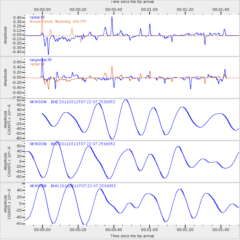
MOOW Moose Ponds, Wyoming, USA - Earthquake Result Viewer
*The percent match for this event was below the threshold and hence no stack was calculated.
| Earthquake location: |
Off East Coast Of Honshu, Japan |
| Earthquake latitude/longitude: |
37.9/142.7 |
| Earthquake time(UTC): |
2011/03/11 (070) 07:10:59 GMT |
| Earthquake Depth: |
34 km |
| Earthquake Magnitude: |
5.8 MB |
| Earthquake Catalog/Contributor: |
WHDF/NEIC |
|
| Network: |
IW Intermountain West |
| Station: |
MOOW Moose Ponds, Wyoming, USA |
| Lat/Lon: |
43.75 N/110.74 W |
| Elevation: |
2128 m |
|
| Distance: |
75.1 deg |
| Az: |
45.961 deg |
| Baz: |
308.285 deg |
| Ray Param: |
$rayparam |
*The percent match for this event was below the threshold and hence was not used in the summary stack. |
|
| Radial Match: |
76.546074 % |
| Radial Bump: |
400 |
| Transverse Match: |
60.113487 % |
| Transverse Bump: |
303 |
| SOD ConfigId: |
356183 |
| Insert Time: |
2011-08-11 20:10:08.448 +0000 |
| GWidth: |
2.5 |
| Max Bumps: |
400 |
| Tol: |
0.001 |
|
Signal To Noise
| Channel | StoN | STA | LTA |
| IW:MOOW: :BHZ:20110311T07:22:07.259995Z | 1.5166095 | 5.0272134E-5 | 3.314771E-5 |
| IW:MOOW: :BHN:20110311T07:22:07.259995Z | 1.4339813 | 4.2702675E-5 | 2.9779101E-5 |
| IW:MOOW: :BHE:20110311T07:22:07.259995Z | 2.2534811 | 5.9046753E-5 | 2.6202462E-5 |
| Arrivals |
| Ps | |
| PpPs | |
| PsPs/PpSs | |


