You are here: Home > Network List > TA - USArray Transportable Network (new EarthScope stations) Stations List
> Station R34A Isabella, Hillsboro, KS, USA > Earthquake Result Viewer
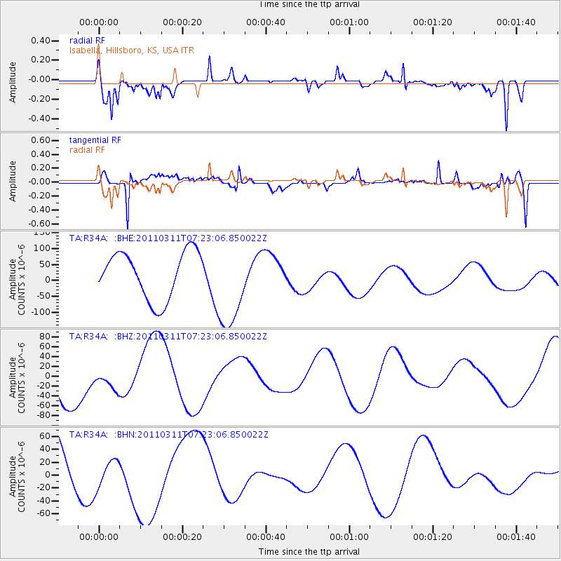
R34A Isabella, Hillsboro, KS, USA - Earthquake Result Viewer
*The percent match for this event was below the threshold and hence no stack was calculated.
| Earthquake location: |
Off East Coast Of Honshu, Japan |
| Earthquake latitude/longitude: |
37.9/142.7 |
| Earthquake time(UTC): |
2011/03/11 (070) 07:10:59 GMT |
| Earthquake Depth: |
34 km |
| Earthquake Magnitude: |
5.8 MB |
| Earthquake Catalog/Contributor: |
WHDF/NEIC |
|
| Network: |
TA USArray Transportable Network (new EarthScope stations) |
| Station: |
R34A Isabella, Hillsboro, KS, USA |
| Lat/Lon: |
38.30 N/97.25 W |
| Elevation: |
437 m |
|
| Distance: |
86.2 deg |
| Az: |
43.027 deg |
| Baz: |
316.665 deg |
| Ray Param: |
$rayparam |
*The percent match for this event was below the threshold and hence was not used in the summary stack. |
|
| Radial Match: |
61.80045 % |
| Radial Bump: |
400 |
| Transverse Match: |
78.156975 % |
| Transverse Bump: |
400 |
| SOD ConfigId: |
356183 |
| Insert Time: |
2011-08-11 20:40:48.689 +0000 |
| GWidth: |
2.5 |
| Max Bumps: |
400 |
| Tol: |
0.001 |
|
Signal To Noise
| Channel | StoN | STA | LTA |
| TA:R34A: :BHZ:20110311T07:23:06.850022Z | 0.30613106 | 1.8969466E-5 | 6.196518E-5 |
| TA:R34A: :BHN:20110311T07:23:06.850022Z | 0.59462875 | 2.0818119E-5 | 3.5010282E-5 |
| TA:R34A: :BHE:20110311T07:23:06.850022Z | 1.8916956 | 1.3928289E-4 | 7.362859E-5 |
| Arrivals |
| Ps | |
| PpPs | |
| PsPs/PpSs | |


