You are here: Home > Network List > TA - USArray Transportable Network (new EarthScope stations) Stations List
> Station Z36A Blue Ridge, TX, USA > Earthquake Result Viewer
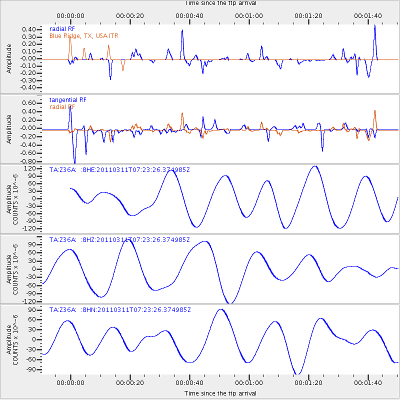
Z36A Blue Ridge, TX, USA - Earthquake Result Viewer
*The percent match for this event was below the threshold and hence no stack was calculated.
| Earthquake location: |
Off East Coast Of Honshu, Japan |
| Earthquake latitude/longitude: |
37.9/142.7 |
| Earthquake time(UTC): |
2011/03/11 (070) 07:10:59 GMT |
| Earthquake Depth: |
34 km |
| Earthquake Magnitude: |
5.8 MB |
| Earthquake Catalog/Contributor: |
WHDF/NEIC |
|
| Network: |
TA USArray Transportable Network (new EarthScope stations) |
| Station: |
Z36A Blue Ridge, TX, USA |
| Lat/Lon: |
33.27 N/96.43 W |
| Elevation: |
187 m |
|
| Distance: |
90.4 deg |
| Az: |
45.972 deg |
| Baz: |
317.226 deg |
| Ray Param: |
$rayparam |
*The percent match for this event was below the threshold and hence was not used in the summary stack. |
|
| Radial Match: |
55.992397 % |
| Radial Bump: |
300 |
| Transverse Match: |
59.056564 % |
| Transverse Bump: |
400 |
| SOD ConfigId: |
356183 |
| Insert Time: |
2011-08-11 20:41:33.784 +0000 |
| GWidth: |
2.5 |
| Max Bumps: |
400 |
| Tol: |
0.001 |
|
Signal To Noise
| Channel | StoN | STA | LTA |
| TA:Z36A: :BHZ:20110311T07:23:26.374985Z | 1.0791025 | 6.212055E-5 | 5.756686E-5 |
| TA:Z36A: :BHN:20110311T07:23:26.374985Z | 1.236789 | 4.3437845E-5 | 3.512147E-5 |
| TA:Z36A: :BHE:20110311T07:23:26.374985Z | 2.7816415 | 9.387066E-5 | 3.37465E-5 |
| Arrivals |
| Ps | |
| PpPs | |
| PsPs/PpSs | |


