You are here: Home > Network List > TA - USArray Transportable Network (new EarthScope stations) Stations List
> Station U35A Pawnee, OK, USA > Earthquake Result Viewer
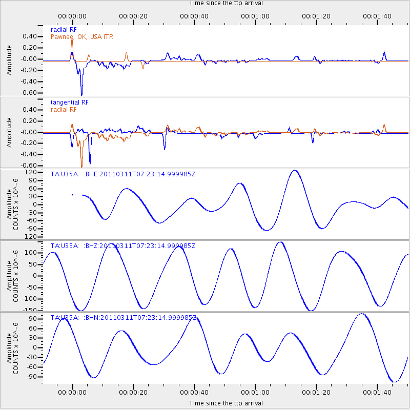
U35A Pawnee, OK, USA - Earthquake Result Viewer
*The percent match for this event was below the threshold and hence no stack was calculated.
| Earthquake location: |
Off East Coast Of Honshu, Japan |
| Earthquake latitude/longitude: |
37.9/142.7 |
| Earthquake time(UTC): |
2011/03/11 (070) 07:10:59 GMT |
| Earthquake Depth: |
34 km |
| Earthquake Magnitude: |
5.8 MB |
| Earthquake Catalog/Contributor: |
WHDF/NEIC |
|
| Network: |
TA USArray Transportable Network (new EarthScope stations) |
| Station: |
U35A Pawnee, OK, USA |
| Lat/Lon: |
36.37 N/96.73 W |
| Elevation: |
303 m |
|
| Distance: |
87.9 deg |
| Az: |
44.046 deg |
| Baz: |
317.028 deg |
| Ray Param: |
$rayparam |
*The percent match for this event was below the threshold and hence was not used in the summary stack. |
|
| Radial Match: |
74.11819 % |
| Radial Bump: |
400 |
| Transverse Match: |
78.71134 % |
| Transverse Bump: |
400 |
| SOD ConfigId: |
356183 |
| Insert Time: |
2011-08-11 20:42:40.859 +0000 |
| GWidth: |
2.5 |
| Max Bumps: |
400 |
| Tol: |
0.001 |
|
Signal To Noise
| Channel | StoN | STA | LTA |
| TA:U35A: :BHZ:20110311T07:23:14.999985Z | 2.8156574 | 1.3883259E-4 | 4.9307346E-5 |
| TA:U35A: :BHN:20110311T07:23:14.999985Z | 1.3991926 | 4.6790723E-5 | 3.344123E-5 |
| TA:U35A: :BHE:20110311T07:23:14.999985Z | 1.7469999 | 6.03641E-5 | 3.4553006E-5 |
| Arrivals |
| Ps | |
| PpPs | |
| PsPs/PpSs | |


