You are here: Home > Network List > AK - Alaska Regional Network Stations List
> Station MDM Murphy Dome > Earthquake Result Viewer
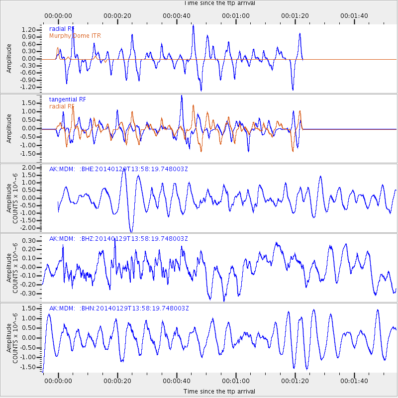
MDM Murphy Dome - Earthquake Result Viewer
*The percent match for this event was below the threshold and hence no stack was calculated.
| Earthquake location: |
Myanmar-India Border Region |
| Earthquake latitude/longitude: |
23.8/93.9 |
| Earthquake time(UTC): |
2014/01/29 (029) 13:46:50 GMT |
| Earthquake Depth: |
59 km |
| Earthquake Magnitude: |
5.1 MW |
| Earthquake Catalog/Contributor: |
ISC/ISC |
|
| Network: |
AK Alaska Regional Network |
| Station: |
MDM Murphy Dome |
| Lat/Lon: |
64.96 N/148.23 W |
| Elevation: |
634 m |
|
| Distance: |
79.6 deg |
| Az: |
22.496 deg |
| Baz: |
304.583 deg |
| Ray Param: |
$rayparam |
*The percent match for this event was below the threshold and hence was not used in the summary stack. |
|
| Radial Match: |
66.08597 % |
| Radial Bump: |
400 |
| Transverse Match: |
65.992905 % |
| Transverse Bump: |
400 |
| SOD ConfigId: |
3390531 |
| Insert Time: |
2019-04-10 04:09:09.615 +0000 |
| GWidth: |
2.5 |
| Max Bumps: |
400 |
| Tol: |
0.001 |
|
Signal To Noise
| Channel | StoN | STA | LTA |
| AK:MDM: :BHZ:20140129T13:58:19.748003Z | 0.69053036 | 1.5018607E-7 | 2.1749379E-7 |
| AK:MDM: :BHN:20140129T13:58:19.748003Z | 0.8168314 | 5.2346206E-7 | 6.408447E-7 |
| AK:MDM: :BHE:20140129T13:58:19.748003Z | 0.6457798 | 4.8935254E-7 | 7.5777007E-7 |
| Arrivals |
| Ps | |
| PpPs | |
| PsPs/PpSs | |


