You are here: Home > Network List > TA - USArray Transportable Network (new EarthScope stations) Stations List
> Station M36A Felix, Anita, IA, USA > Earthquake Result Viewer
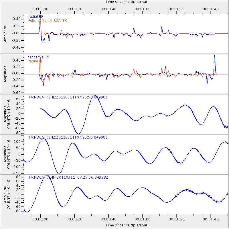
M36A Felix, Anita, IA, USA - Earthquake Result Viewer
*The percent match for this event was below the threshold and hence no stack was calculated.
| Earthquake location: |
Off East Coast Of Honshu, Japan |
| Earthquake latitude/longitude: |
36.1/142.4 |
| Earthquake time(UTC): |
2011/03/11 (070) 07:13:47 GMT |
| Earthquake Depth: |
35 km |
| Earthquake Magnitude: |
5.9 MB |
| Earthquake Catalog/Contributor: |
WHDF/NEIC |
|
| Network: |
TA USArray Transportable Network (new EarthScope stations) |
| Station: |
M36A Felix, Anita, IA, USA |
| Lat/Lon: |
41.45 N/94.80 W |
| Elevation: |
430 m |
|
| Distance: |
86.7 deg |
| Az: |
39.241 deg |
| Baz: |
317.038 deg |
| Ray Param: |
$rayparam |
*The percent match for this event was below the threshold and hence was not used in the summary stack. |
|
| Radial Match: |
67.217865 % |
| Radial Bump: |
400 |
| Transverse Match: |
53.878296 % |
| Transverse Bump: |
400 |
| SOD ConfigId: |
356183 |
| Insert Time: |
2011-08-11 22:24:37.585 +0000 |
| GWidth: |
2.5 |
| Max Bumps: |
400 |
| Tol: |
0.001 |
|
Signal To Noise
| Channel | StoN | STA | LTA |
| TA:M36A: :BHZ:20110311T07:25:56.84998Z | 2.4447296 | 1.1812631E-4 | 4.831876E-5 |
| TA:M36A: :BHN:20110311T07:25:56.84998Z | 1.5967956 | 8.858162E-5 | 5.5474615E-5 |
| TA:M36A: :BHE:20110311T07:25:56.84998Z | 2.487007 | 8.248168E-5 | 3.316504E-5 |
| Arrivals |
| Ps | |
| PpPs | |
| PsPs/PpSs | |


