You are here: Home > Network List > IW - Intermountain West Stations List
> Station DLMT Dillon, Montana, USA > Earthquake Result Viewer
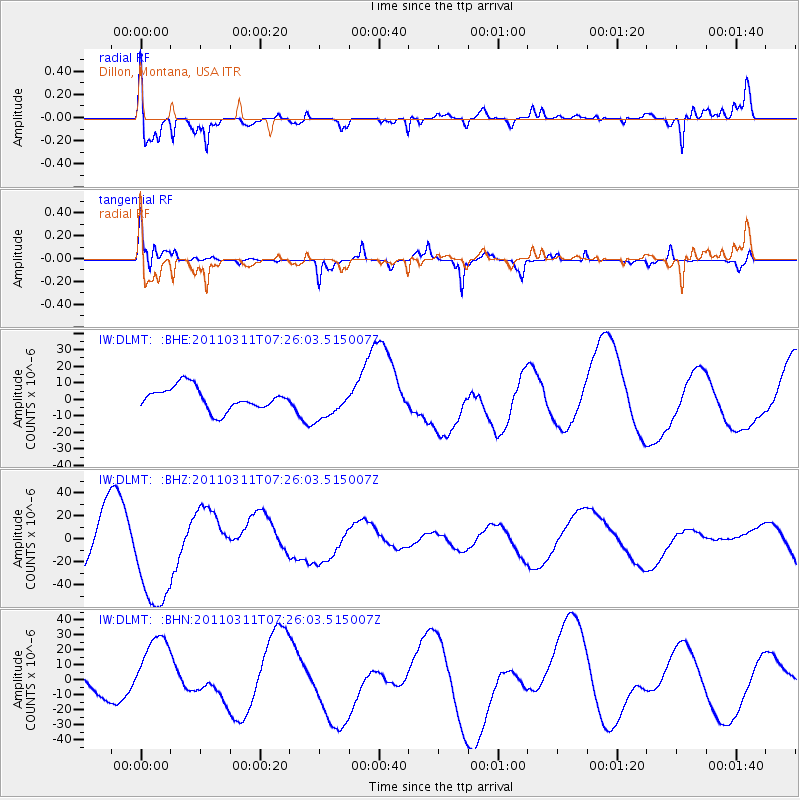
DLMT Dillon, Montana, USA - Earthquake Result Viewer
*The percent match for this event was below the threshold and hence no stack was calculated.
| Earthquake location: |
Near East Coast Of Honshu, Japan |
| Earthquake latitude/longitude: |
36.6/141.8 |
| Earthquake time(UTC): |
2011/03/11 (070) 07:14:58 GMT |
| Earthquake Depth: |
25 km |
| Earthquake Magnitude: |
6.3 MB |
| Earthquake Catalog/Contributor: |
WHDF/NEIC |
|
| Network: |
IW Intermountain West |
| Station: |
DLMT Dillon, Montana, USA |
| Lat/Lon: |
45.36 N/112.60 W |
| Elevation: |
1569 m |
|
| Distance: |
74.4 deg |
| Az: |
44.828 deg |
| Baz: |
306.405 deg |
| Ray Param: |
$rayparam |
*The percent match for this event was below the threshold and hence was not used in the summary stack. |
|
| Radial Match: |
58.059956 % |
| Radial Bump: |
399 |
| Transverse Match: |
41.549385 % |
| Transverse Bump: |
220 |
| SOD ConfigId: |
356183 |
| Insert Time: |
2011-08-11 23:23:11.010 +0000 |
| GWidth: |
2.5 |
| Max Bumps: |
400 |
| Tol: |
0.001 |
|
Signal To Noise
| Channel | StoN | STA | LTA |
| IW:DLMT: :BHZ:20110311T07:26:03.515007Z | 1.2555621 | 4.6153225E-5 | 3.6759015E-5 |
| IW:DLMT: :BHN:20110311T07:26:03.515007Z | 2.3876972 | 2.5022402E-5 | 1.0479721E-5 |
| IW:DLMT: :BHE:20110311T07:26:03.515007Z | 1.4160368 | 9.637201E-6 | 6.805756E-6 |
| Arrivals |
| Ps | |
| PpPs | |
| PsPs/PpSs | |


