You are here: Home > Network List > TA - USArray Transportable Network (new EarthScope stations) Stations List
> Station MSTX Muleshoe, TX, USA > Earthquake Result Viewer
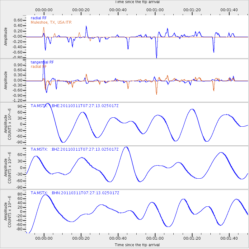
MSTX Muleshoe, TX, USA - Earthquake Result Viewer
*The percent match for this event was below the threshold and hence no stack was calculated.
| Earthquake location: |
Near East Coast Of Honshu, Japan |
| Earthquake latitude/longitude: |
36.6/141.8 |
| Earthquake time(UTC): |
2011/03/11 (070) 07:14:58 GMT |
| Earthquake Depth: |
25 km |
| Earthquake Magnitude: |
6.3 MB |
| Earthquake Catalog/Contributor: |
WHDF/NEIC |
|
| Network: |
TA USArray Transportable Network (new EarthScope stations) |
| Station: |
MSTX Muleshoe, TX, USA |
| Lat/Lon: |
33.97 N/102.77 W |
| Elevation: |
1167 m |
|
| Distance: |
87.5 deg |
| Az: |
48.712 deg |
| Baz: |
313.305 deg |
| Ray Param: |
$rayparam |
*The percent match for this event was below the threshold and hence was not used in the summary stack. |
|
| Radial Match: |
48.15194 % |
| Radial Bump: |
295 |
| Transverse Match: |
67.69495 % |
| Transverse Bump: |
400 |
| SOD ConfigId: |
356183 |
| Insert Time: |
2011-08-11 23:36:21.256 +0000 |
| GWidth: |
2.5 |
| Max Bumps: |
400 |
| Tol: |
0.001 |
|
Signal To Noise
| Channel | StoN | STA | LTA |
| TA:MSTX: :BHZ:20110311T07:27:13.025017Z | 0.86244184 | 1.672202E-5 | 1.9389157E-5 |
| TA:MSTX: :BHN:20110311T07:27:13.025017Z | 1.5203575 | 8.162672E-5 | 5.3689164E-5 |
| TA:MSTX: :BHE:20110311T07:27:13.025017Z | 0.7993987 | 4.9751077E-5 | 6.2235624E-5 |
| Arrivals |
| Ps | |
| PpPs | |
| PsPs/PpSs | |


