You are here: Home > Network List > TA - USArray Transportable Network (new EarthScope stations) Stations List
> Station X37A Clayton, OK, USA > Earthquake Result Viewer
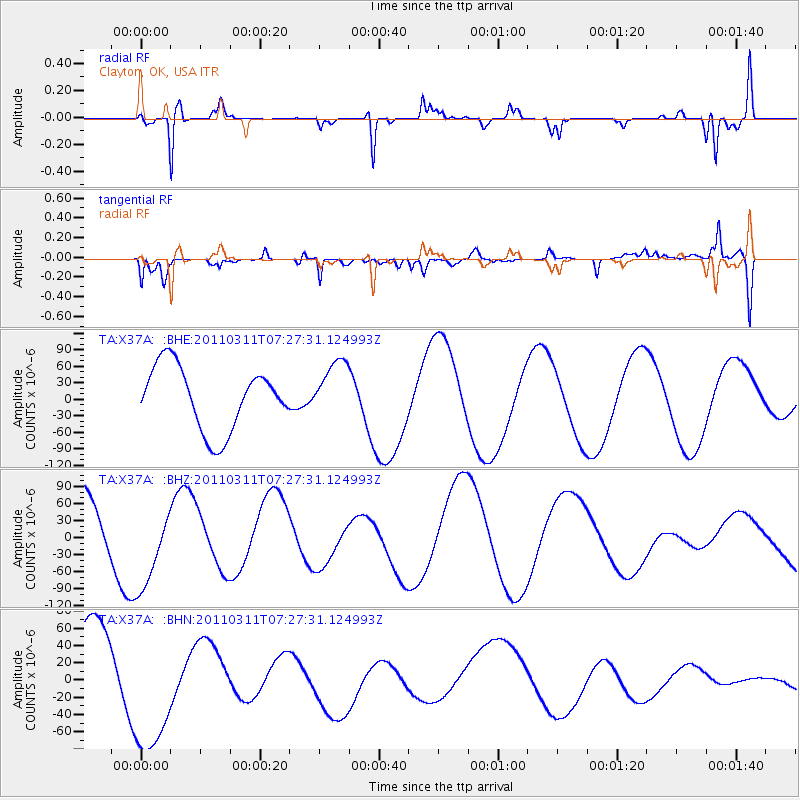
X37A Clayton, OK, USA - Earthquake Result Viewer
*The percent match for this event was below the threshold and hence no stack was calculated.
| Earthquake location: |
Near East Coast Of Honshu, Japan |
| Earthquake latitude/longitude: |
36.6/141.8 |
| Earthquake time(UTC): |
2011/03/11 (070) 07:14:58 GMT |
| Earthquake Depth: |
25 km |
| Earthquake Magnitude: |
6.3 MB |
| Earthquake Catalog/Contributor: |
WHDF/NEIC |
|
| Network: |
TA USArray Transportable Network (new EarthScope stations) |
| Station: |
X37A Clayton, OK, USA |
| Lat/Lon: |
34.59 N/95.37 W |
| Elevation: |
207 m |
|
| Distance: |
91.4 deg |
| Az: |
43.919 deg |
| Baz: |
317.413 deg |
| Ray Param: |
$rayparam |
*The percent match for this event was below the threshold and hence was not used in the summary stack. |
|
| Radial Match: |
69.97479 % |
| Radial Bump: |
232 |
| Transverse Match: |
66.4034 % |
| Transverse Bump: |
400 |
| SOD ConfigId: |
356183 |
| Insert Time: |
2011-08-11 23:56:28.710 +0000 |
| GWidth: |
2.5 |
| Max Bumps: |
400 |
| Tol: |
0.001 |
|
Signal To Noise
| Channel | StoN | STA | LTA |
| TA:X37A: :BHZ:20110311T07:27:31.124993Z | 1.3856183 | 7.584109E-5 | 5.4734468E-5 |
| TA:X37A: :BHN:20110311T07:27:31.124993Z | 1.8161198 | 8.588284E-5 | 4.728919E-5 |
| TA:X37A: :BHE:20110311T07:27:31.124993Z | 0.9150121 | 5.2391973E-5 | 5.725823E-5 |
| Arrivals |
| Ps | |
| PpPs | |
| PsPs/PpSs | |


