You are here: Home > Network List > TA - USArray Transportable Network (new EarthScope stations) Stations List
> Station D33A AnnSam, Waubun, MN, USA > Earthquake Result Viewer
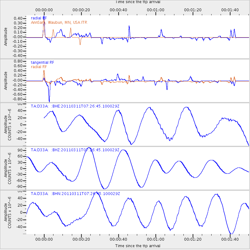
D33A AnnSam, Waubun, MN, USA - Earthquake Result Viewer
*The percent match for this event was below the threshold and hence no stack was calculated.
| Earthquake location: |
Near East Coast Of Honshu, Japan |
| Earthquake latitude/longitude: |
36.6/141.8 |
| Earthquake time(UTC): |
2011/03/11 (070) 07:14:58 GMT |
| Earthquake Depth: |
25 km |
| Earthquake Magnitude: |
6.3 MB |
| Earthquake Catalog/Contributor: |
WHDF/NEIC |
|
| Network: |
TA USArray Transportable Network (new EarthScope stations) |
| Station: |
D33A AnnSam, Waubun, MN, USA |
| Lat/Lon: |
47.14 N/95.84 W |
| Elevation: |
466 m |
|
| Distance: |
82.0 deg |
| Az: |
35.629 deg |
| Baz: |
316.62 deg |
| Ray Param: |
$rayparam |
*The percent match for this event was below the threshold and hence was not used in the summary stack. |
|
| Radial Match: |
49.931076 % |
| Radial Bump: |
400 |
| Transverse Match: |
88.16553 % |
| Transverse Bump: |
328 |
| SOD ConfigId: |
356183 |
| Insert Time: |
2011-08-12 00:04:51.153 +0000 |
| GWidth: |
2.5 |
| Max Bumps: |
400 |
| Tol: |
0.001 |
|
Signal To Noise
| Channel | StoN | STA | LTA |
| TA:D33A: :BHZ:20110311T07:26:45.100029Z | 0.32680076 | 1.7583978E-5 | 5.380642E-5 |
| TA:D33A: :BHN:20110311T07:26:45.100029Z | 0.47670427 | 1.6223872E-5 | 3.403341E-5 |
| TA:D33A: :BHE:20110311T07:26:45.100029Z | 2.8886034 | 5.098793E-5 | 1.7651411E-5 |
| Arrivals |
| Ps | |
| PpPs | |
| PsPs/PpSs | |


