You are here: Home > Network List > TA - USArray Transportable Network (new EarthScope stations) Stations List
> Station 136A Ennis, TX, USA > Earthquake Result Viewer
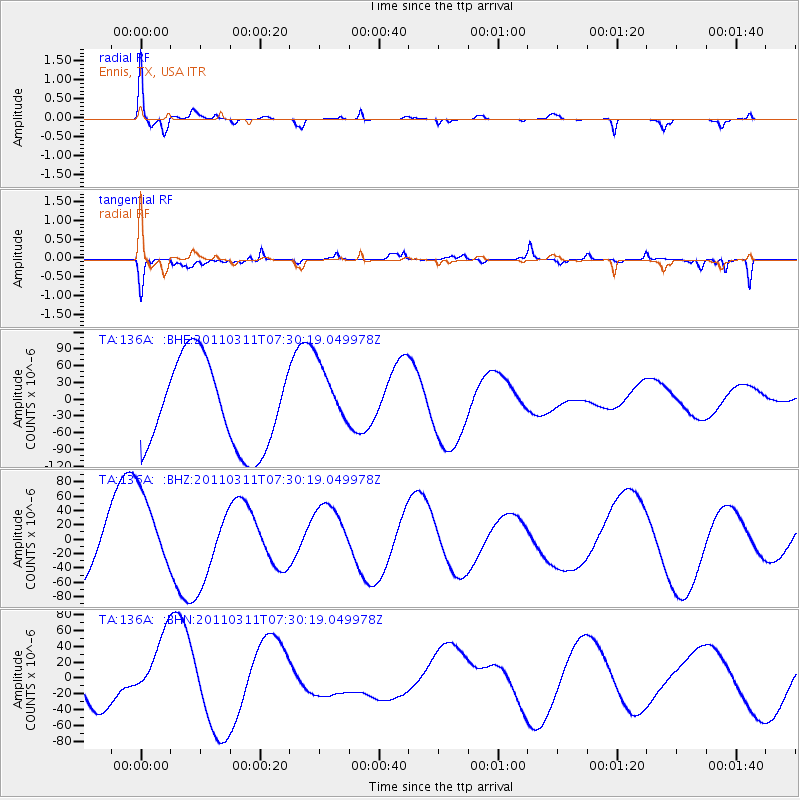
136A Ennis, TX, USA - Earthquake Result Viewer
*The percent match for this event was below the threshold and hence no stack was calculated.
| Earthquake location: |
Off East Coast Of Honshu, Japan |
| Earthquake latitude/longitude: |
37.0/142.4 |
| Earthquake time(UTC): |
2011/03/11 (070) 07:17:42 GMT |
| Earthquake Depth: |
6.3 km |
| Earthquake Magnitude: |
5.8 MB |
| Earthquake Catalog/Contributor: |
WHDF/NEIC |
|
| Network: |
TA USArray Transportable Network (new EarthScope stations) |
| Station: |
136A Ennis, TX, USA |
| Lat/Lon: |
32.47 N/96.53 W |
| Elevation: |
113 m |
|
| Distance: |
91.7 deg |
| Az: |
46.414 deg |
| Baz: |
316.686 deg |
| Ray Param: |
$rayparam |
*The percent match for this event was below the threshold and hence was not used in the summary stack. |
|
| Radial Match: |
73.79087 % |
| Radial Bump: |
337 |
| Transverse Match: |
67.846664 % |
| Transverse Bump: |
400 |
| SOD ConfigId: |
356183 |
| Insert Time: |
2011-08-12 01:26:40.484 +0000 |
| GWidth: |
2.5 |
| Max Bumps: |
400 |
| Tol: |
0.001 |
|
Signal To Noise
| Channel | StoN | STA | LTA |
| TA:136A: :BHZ:20110311T07:30:19.049978Z | 1.418607 | 5.571518E-5 | 3.9274568E-5 |
| TA:136A: :BHN:20110311T07:30:19.049978Z | 2.3471346 | 4.6025598E-5 | 1.9609271E-5 |
| TA:136A: :BHE:20110311T07:30:19.049978Z | 0.73033816 | 5.666512E-5 | 7.7587516E-5 |
| Arrivals |
| Ps | |
| PpPs | |
| PsPs/PpSs | |


