You are here: Home > Network List > TA - USArray Transportable Network (new EarthScope stations) Stations List
> Station H34A Spellman Lake, Hanley Falls, MN, USA > Earthquake Result Viewer
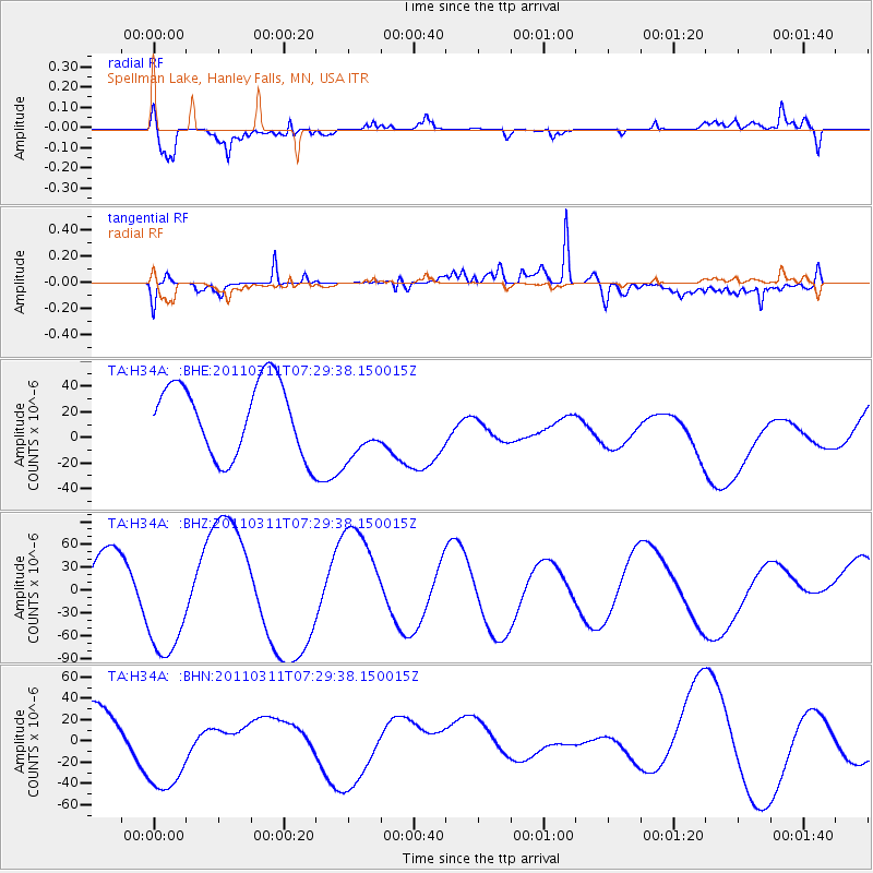
H34A Spellman Lake, Hanley Falls, MN, USA - Earthquake Result Viewer
*The percent match for this event was below the threshold and hence no stack was calculated.
| Earthquake location: |
Off East Coast Of Honshu, Japan |
| Earthquake latitude/longitude: |
37.0/142.4 |
| Earthquake time(UTC): |
2011/03/11 (070) 07:17:42 GMT |
| Earthquake Depth: |
6.3 km |
| Earthquake Magnitude: |
5.8 MB |
| Earthquake Catalog/Contributor: |
WHDF/NEIC |
|
| Network: |
TA USArray Transportable Network (new EarthScope stations) |
| Station: |
H34A Spellman Lake, Hanley Falls, MN, USA |
| Lat/Lon: |
44.67 N/95.78 W |
| Elevation: |
329 m |
|
| Distance: |
83.2 deg |
| Az: |
37.637 deg |
| Baz: |
316.759 deg |
| Ray Param: |
$rayparam |
*The percent match for this event was below the threshold and hence was not used in the summary stack. |
|
| Radial Match: |
41.035923 % |
| Radial Bump: |
400 |
| Transverse Match: |
75.49899 % |
| Transverse Bump: |
400 |
| SOD ConfigId: |
356183 |
| Insert Time: |
2011-08-12 01:27:46.384 +0000 |
| GWidth: |
2.5 |
| Max Bumps: |
400 |
| Tol: |
0.001 |
|
Signal To Noise
| Channel | StoN | STA | LTA |
| TA:H34A: :BHZ:20110311T07:29:38.150015Z | 1.683827 | 7.511144E-5 | 4.4607576E-5 |
| TA:H34A: :BHN:20110311T07:29:38.150015Z | 1.9682491 | 5.231263E-5 | 2.6578256E-5 |
| TA:H34A: :BHE:20110311T07:29:38.150015Z | 0.935569 | 2.6529016E-5 | 2.8356024E-5 |
| Arrivals |
| Ps | |
| PpPs | |
| PsPs/PpSs | |


