You are here: Home > Network List > TA - USArray Transportable Network (new EarthScope stations) Stations List
> Station O56A Blue Knob State Park, Imler, PA, USA > Earthquake Result Viewer
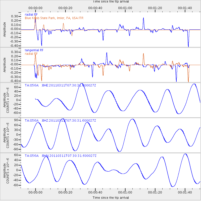
O56A Blue Knob State Park, Imler, PA, USA - Earthquake Result Viewer
*The percent match for this event was below the threshold and hence no stack was calculated.
| Earthquake location: |
Off East Coast Of Honshu, Japan |
| Earthquake latitude/longitude: |
37.0/142.4 |
| Earthquake time(UTC): |
2011/03/11 (070) 07:17:42 GMT |
| Earthquake Depth: |
6.3 km |
| Earthquake Magnitude: |
5.8 MB |
| Earthquake Catalog/Contributor: |
WHDF/NEIC |
|
| Network: |
TA USArray Transportable Network (new EarthScope stations) |
| Station: |
O56A Blue Knob State Park, Imler, PA, USA |
| Lat/Lon: |
40.27 N/78.57 W |
| Elevation: |
684 m |
|
| Distance: |
94.4 deg |
| Az: |
30.211 deg |
| Baz: |
328.235 deg |
| Ray Param: |
$rayparam |
*The percent match for this event was below the threshold and hence was not used in the summary stack. |
|
| Radial Match: |
80.69644 % |
| Radial Bump: |
378 |
| Transverse Match: |
88.69324 % |
| Transverse Bump: |
400 |
| SOD ConfigId: |
356183 |
| Insert Time: |
2011-08-12 01:33:54.522 +0000 |
| GWidth: |
2.5 |
| Max Bumps: |
400 |
| Tol: |
0.001 |
|
Signal To Noise
| Channel | StoN | STA | LTA |
| TA:O56A: :BHZ:20110311T07:30:31.600027Z | 1.71729 | 7.179132E-5 | 4.1805008E-5 |
| TA:O56A: :BHN:20110311T07:30:31.600027Z | 0.61897725 | 2.3642999E-5 | 3.819688E-5 |
| TA:O56A: :BHE:20110311T07:30:31.600027Z | 4.528665 | 7.7434066E-5 | 1.7098651E-5 |
| Arrivals |
| Ps | |
| PpPs | |
| PsPs/PpSs | |


