You are here: Home > Network List > TA - USArray Transportable Network (new EarthScope stations) Stations List
> Station SFIN Lafayette, IN, USA > Earthquake Result Viewer
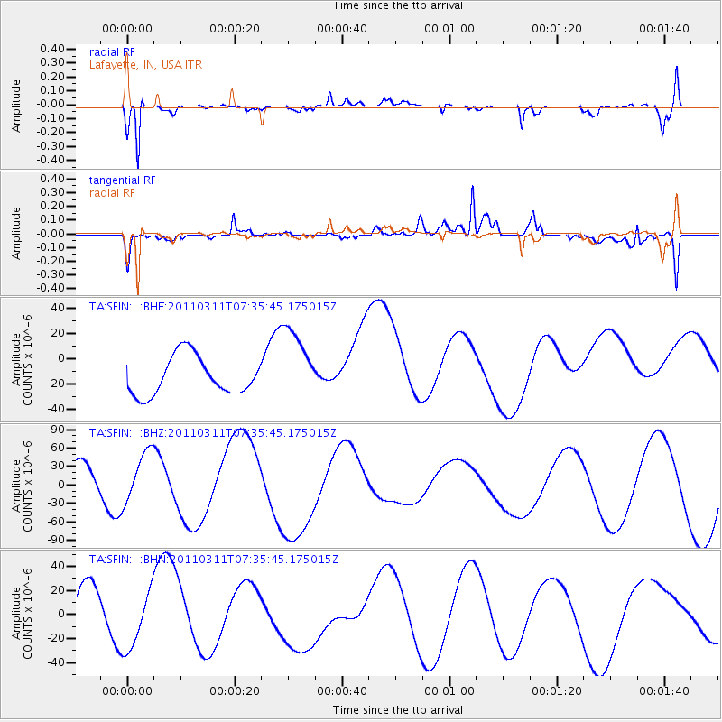
SFIN Lafayette, IN, USA - Earthquake Result Viewer
*The percent match for this event was below the threshold and hence no stack was calculated.
| Earthquake location: |
Off East Coast Of Honshu, Japan |
| Earthquake latitude/longitude: |
37.5/142.1 |
| Earthquake time(UTC): |
2011/03/11 (070) 07:23:16 GMT |
| Earthquake Depth: |
20 km |
| Earthquake Magnitude: |
5.9 MB |
| Earthquake Catalog/Contributor: |
WHDF/NEIC |
|
| Network: |
TA USArray Transportable Network (new EarthScope stations) |
| Station: |
SFIN Lafayette, IN, USA |
| Lat/Lon: |
40.38 N/87.10 W |
| Elevation: |
165 m |
|
| Distance: |
90.4 deg |
| Az: |
35.327 deg |
| Baz: |
322.96 deg |
| Ray Param: |
$rayparam |
*The percent match for this event was below the threshold and hence was not used in the summary stack. |
|
| Radial Match: |
73.23448 % |
| Radial Bump: |
400 |
| Transverse Match: |
72.028824 % |
| Transverse Bump: |
400 |
| SOD ConfigId: |
356183 |
| Insert Time: |
2011-08-12 02:35:07.726 +0000 |
| GWidth: |
2.5 |
| Max Bumps: |
400 |
| Tol: |
0.001 |
|
Signal To Noise
| Channel | StoN | STA | LTA |
| TA:SFIN: :BHZ:20110311T07:35:45.175015Z | 1.0850987 | 4.1532978E-5 | 3.827576E-5 |
| TA:SFIN: :BHN:20110311T07:35:45.175015Z | 0.90379214 | 2.2473403E-5 | 2.4865676E-5 |
| TA:SFIN: :BHE:20110311T07:35:45.175015Z | 1.989241 | 3.0046613E-5 | 1.51045615E-5 |
| Arrivals |
| Ps | |
| PpPs | |
| PsPs/PpSs | |


