You are here: Home > Network List > TA - USArray Transportable Network (new EarthScope stations) Stations List
> Station X33A Lawton, OK, USA > Earthquake Result Viewer
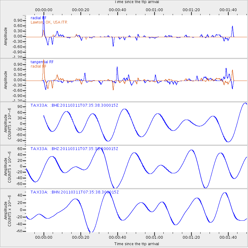
X33A Lawton, OK, USA - Earthquake Result Viewer
*The percent match for this event was below the threshold and hence no stack was calculated.
| Earthquake location: |
Off East Coast Of Honshu, Japan |
| Earthquake latitude/longitude: |
37.5/142.1 |
| Earthquake time(UTC): |
2011/03/11 (070) 07:23:16 GMT |
| Earthquake Depth: |
20 km |
| Earthquake Magnitude: |
5.9 MB |
| Earthquake Catalog/Contributor: |
WHDF/NEIC |
|
| Network: |
TA USArray Transportable Network (new EarthScope stations) |
| Station: |
X33A Lawton, OK, USA |
| Lat/Lon: |
34.54 N/98.50 W |
| Elevation: |
346 m |
|
| Distance: |
88.9 deg |
| Az: |
45.997 deg |
| Baz: |
316.098 deg |
| Ray Param: |
$rayparam |
*The percent match for this event was below the threshold and hence was not used in the summary stack. |
|
| Radial Match: |
69.40409 % |
| Radial Bump: |
400 |
| Transverse Match: |
76.17802 % |
| Transverse Bump: |
375 |
| SOD ConfigId: |
356183 |
| Insert Time: |
2011-08-12 02:46:32.507 +0000 |
| GWidth: |
2.5 |
| Max Bumps: |
400 |
| Tol: |
0.001 |
|
Signal To Noise
| Channel | StoN | STA | LTA |
| TA:X33A: :BHZ:20110311T07:35:38.300015Z | 1.0092443 | 2.5481713E-5 | 2.5248308E-5 |
| TA:X33A: :BHN:20110311T07:35:38.300015Z | 1.4781951 | 3.505475E-5 | 2.3714563E-5 |
| TA:X33A: :BHE:20110311T07:35:38.300015Z | 1.6664028 | 6.070014E-5 | 3.642585E-5 |
| Arrivals |
| Ps | |
| PpPs | |
| PsPs/PpSs | |


