You are here: Home > Network List > TA - USArray Transportable Network (new EarthScope stations) Stations List
> Station R36A Gordon, Harris, KS, USA > Earthquake Result Viewer
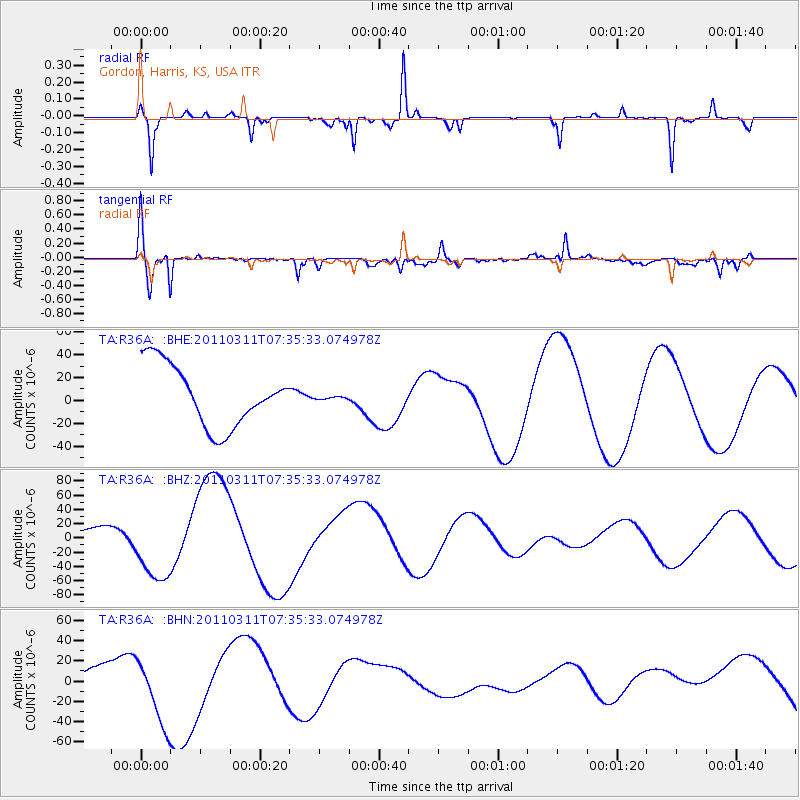
R36A Gordon, Harris, KS, USA - Earthquake Result Viewer
*The percent match for this event was below the threshold and hence no stack was calculated.
| Earthquake location: |
Off East Coast Of Honshu, Japan |
| Earthquake latitude/longitude: |
37.5/142.1 |
| Earthquake time(UTC): |
2011/03/11 (070) 07:23:16 GMT |
| Earthquake Depth: |
20 km |
| Earthquake Magnitude: |
5.9 MB |
| Earthquake Catalog/Contributor: |
WHDF/NEIC |
|
| Network: |
TA USArray Transportable Network (new EarthScope stations) |
| Station: |
R36A Gordon, Harris, KS, USA |
| Lat/Lon: |
38.32 N/95.50 W |
| Elevation: |
354 m |
|
| Distance: |
87.8 deg |
| Az: |
41.652 deg |
| Baz: |
317.745 deg |
| Ray Param: |
$rayparam |
*The percent match for this event was below the threshold and hence was not used in the summary stack. |
|
| Radial Match: |
66.72201 % |
| Radial Bump: |
156 |
| Transverse Match: |
80.90238 % |
| Transverse Bump: |
400 |
| SOD ConfigId: |
356183 |
| Insert Time: |
2011-08-12 02:52:47.675 +0000 |
| GWidth: |
2.5 |
| Max Bumps: |
400 |
| Tol: |
0.001 |
|
Signal To Noise
| Channel | StoN | STA | LTA |
| TA:R36A: :BHZ:20110311T07:35:33.074978Z | 2.7749627 | 4.558316E-5 | 1.6426586E-5 |
| TA:R36A: :BHN:20110311T07:35:33.074978Z | 2.888543 | 3.75729E-5 | 1.3007561E-5 |
| TA:R36A: :BHE:20110311T07:35:33.074978Z | 0.052703917 | 1.3976708E-6 | 2.6519296E-5 |
| Arrivals |
| Ps | |
| PpPs | |
| PsPs/PpSs | |


