You are here: Home > Network List > TA - USArray Transportable Network (new EarthScope stations) Stations List
> Station M38A Pleasantville, IA, USA > Earthquake Result Viewer
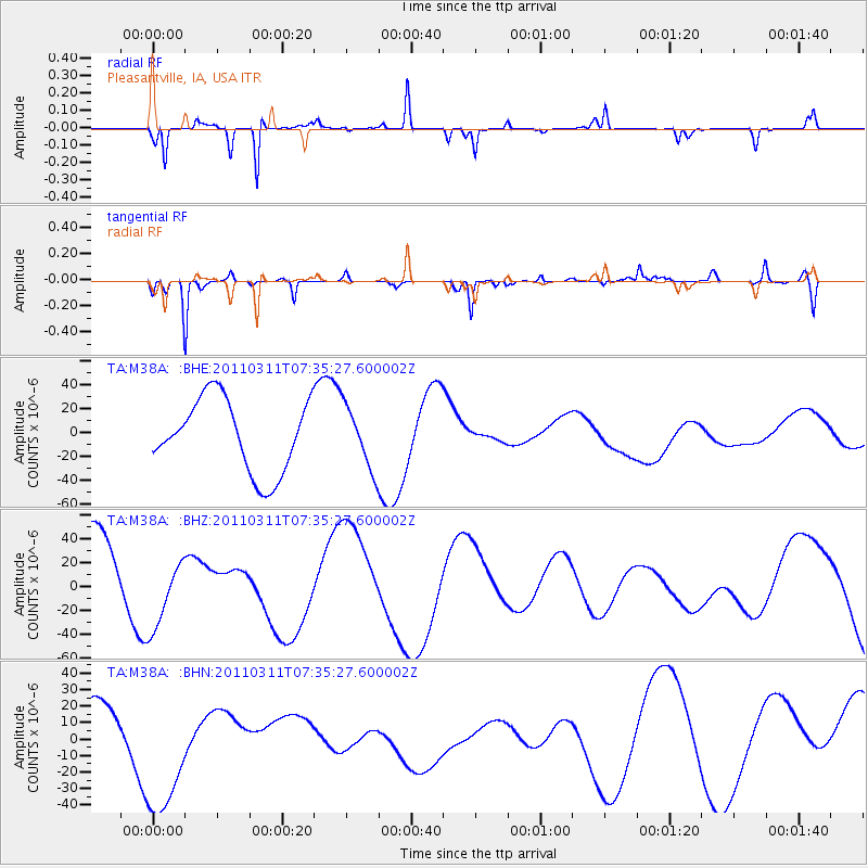
M38A Pleasantville, IA, USA - Earthquake Result Viewer
*The percent match for this event was below the threshold and hence no stack was calculated.
| Earthquake location: |
Off East Coast Of Honshu, Japan |
| Earthquake latitude/longitude: |
37.5/142.1 |
| Earthquake time(UTC): |
2011/03/11 (070) 07:23:16 GMT |
| Earthquake Depth: |
20 km |
| Earthquake Magnitude: |
5.9 MB |
| Earthquake Catalog/Contributor: |
WHDF/NEIC |
|
| Network: |
TA USArray Transportable Network (new EarthScope stations) |
| Station: |
M38A Pleasantville, IA, USA |
| Lat/Lon: |
41.42 N/93.20 W |
| Elevation: |
258 m |
|
| Distance: |
86.7 deg |
| Az: |
38.268 deg |
| Baz: |
319.055 deg |
| Ray Param: |
$rayparam |
*The percent match for this event was below the threshold and hence was not used in the summary stack. |
|
| Radial Match: |
66.84272 % |
| Radial Bump: |
121 |
| Transverse Match: |
64.76313 % |
| Transverse Bump: |
221 |
| SOD ConfigId: |
356183 |
| Insert Time: |
2011-08-12 03:07:43.648 +0000 |
| GWidth: |
2.5 |
| Max Bumps: |
400 |
| Tol: |
0.001 |
|
Signal To Noise
| Channel | StoN | STA | LTA |
| TA:M38A: :BHZ:20110311T07:35:27.600002Z | 0.657929 | 3.276982E-5 | 4.9807535E-5 |
| TA:M38A: :BHN:20110311T07:35:27.600002Z | 2.167 | 4.2966538E-5 | 1.982766E-5 |
| TA:M38A: :BHE:20110311T07:35:27.600002Z | 0.86383396 | 2.5953113E-5 | 3.00441E-5 |
| Arrivals |
| Ps | |
| PpPs | |
| PsPs/PpSs | |


