You are here: Home > Network List > TA - USArray Transportable Network (new EarthScope stations) Stations List
> Station K30A Basset, NE, USA > Earthquake Result Viewer
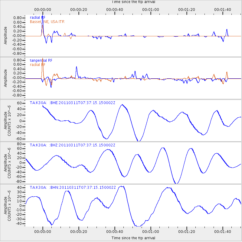
K30A Basset, NE, USA - Earthquake Result Viewer
*The percent match for this event was below the threshold and hence no stack was calculated.
| Earthquake location: |
Off East Coast Of Honshu, Japan |
| Earthquake latitude/longitude: |
37.9/144.5 |
| Earthquake time(UTC): |
2011/03/11 (070) 07:25:36 GMT |
| Earthquake Depth: |
40 km |
| Earthquake Magnitude: |
6.1 MB |
| Earthquake Catalog/Contributor: |
WHDF/NEIC |
|
| Network: |
TA USArray Transportable Network (new EarthScope stations) |
| Station: |
K30A Basset, NE, USA |
| Lat/Lon: |
42.67 N/99.61 W |
| Elevation: |
712 m |
|
| Distance: |
80.8 deg |
| Az: |
42.238 deg |
| Baz: |
313.885 deg |
| Ray Param: |
$rayparam |
*The percent match for this event was below the threshold and hence was not used in the summary stack. |
|
| Radial Match: |
62.43167 % |
| Radial Bump: |
400 |
| Transverse Match: |
40.09505 % |
| Transverse Bump: |
400 |
| SOD ConfigId: |
356183 |
| Insert Time: |
2011-08-12 04:25:38.953 +0000 |
| GWidth: |
2.5 |
| Max Bumps: |
400 |
| Tol: |
0.001 |
|
Signal To Noise
| Channel | StoN | STA | LTA |
| TA:K30A: :BHZ:20110311T07:37:15.150002Z | 1.092333 | 1.3231375E-5 | 1.21129515E-5 |
| TA:K30A: :BHN:20110311T07:37:15.150002Z | 1.3422167 | 3.175062E-5 | 2.3655359E-5 |
| TA:K30A: :BHE:20110311T07:37:15.150002Z | 2.6247416 | 4.2313917E-5 | 1.6121176E-5 |
| Arrivals |
| Ps | |
| PpPs | |
| PsPs/PpSs | |


