You are here: Home > Network List > CN - Canadian National Seismograph Network Stations List
> Station INK INUVIK, NT > Earthquake Result Viewer
INK INUVIK, NT - Earthquake Result Viewer
*The percent match for this event was below the threshold and hence no stack was calculated.
| Earthquake location: |
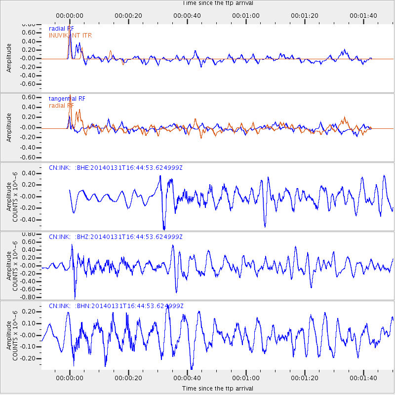
Near East Coast Of Kamchatka |
| Earthquake latitude/longitude: |
54.6/159.7 |
| Earthquake time(UTC): |
2014/01/31 (031) 16:39:06 GMT |
| Earthquake Depth: |
168 km |
| Earthquake Magnitude: |
5.5 MW |
| Earthquake Catalog/Contributor: |
ISC/ISC |
|
| Network: |
CN Canadian National Seismograph Network |
| Station: |
INK INUVIK, NT |
| Lat/Lon: |
68.31 N/133.53 W |
| Elevation: |
44 m |
|
| Distance: |
32.8 deg |
| Az: |
39.094 deg |
| Baz: |
279.531 deg |
| Ray Param: |
$rayparam |
*The percent match for this event was below the threshold and hence was not used in the summary stack. |
|
| Radial Match: |
70.54675 % |
| Radial Bump: |
344 |
| Transverse Match: |
46.706142 % |
| Transverse Bump: |
400 |
| SOD ConfigId: |
3390531 |
| Insert Time: |
2019-04-10 04:20:18.749 +0000 |
| GWidth: |
2.5 |
| Max Bumps: |
400 |
| Tol: |
0.001 |
|
Signal To Noise
| Channel | StoN | STA | LTA |
| CN:INK: :BHZ:20140131T16:44:53.624999Z | 3.009269 | 2.7326146E-7 | 9.080659E-8 |
| CN:INK: :BHN:20140131T16:44:53.624999Z | 1.3013927 | 1.1798085E-7 | 9.065738E-8 |
| CN:INK: :BHE:20140131T16:44:53.624999Z | 3.2072315 | 2.8075573E-7 | 8.753834E-8 |
| Arrivals |
| Ps | |
| PpPs | |
| PsPs/PpSs | |


